
Cheval
Location, Access, Description
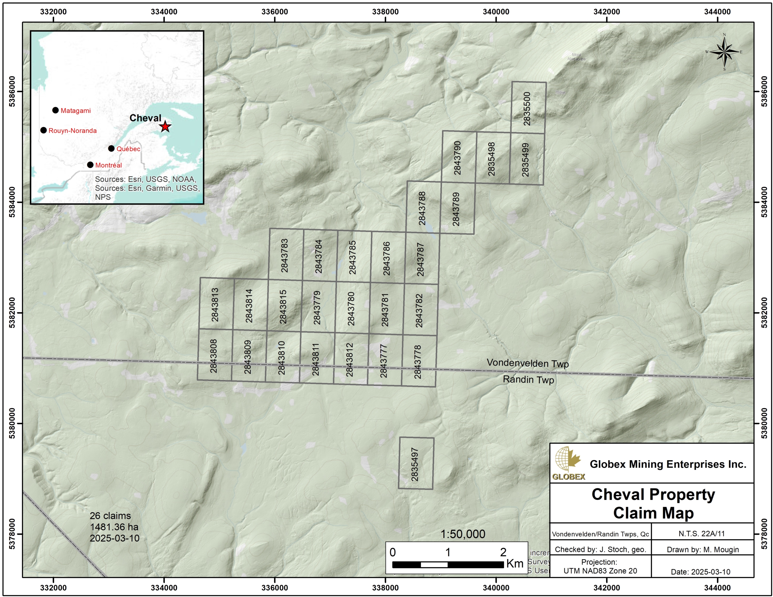
The Cheval property is located in eastern Quebec, about 55 km southwest of Gaspé, in the Gaspésie – Îles de la Madeleine Region. The property consists of 26 mining claims covering 1,481.36 Ha. Globex is 100% owner of the property which is not subject to any third-party interests.
Access by vehicle is possible throughout the entire property via a dense network of gravel roads and forestry trails. Numerous commodities can be found in Gaspé (55 km) and New Richmond (60 km) regarding contractors, skilled labor, equipment rental, as well as sleep and food accommodation of remote workers.
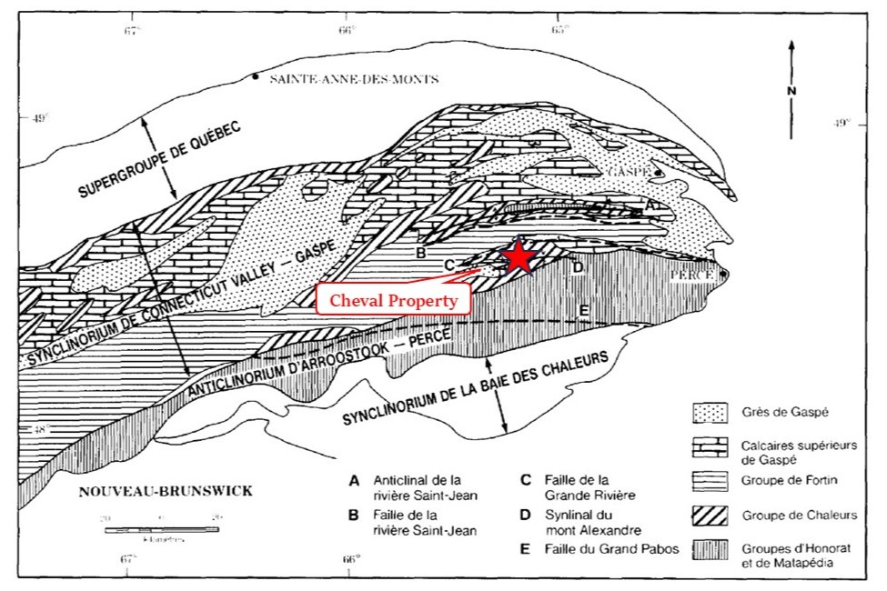
The property is located in the Appalachian Province of the Canadian Shield. The area was mapped several times by geologists of the Quebec Ministère des Ressources Naturelles. The region is characterized by a succession of large ENE-trending thrust nappes composed of Paleozoic sediments, volcanic rocks and intrusions, and deformed by the Acadian orogeny during the Middle Devonian period (ET86-06).
An intense period of volcanic activity was underway during Paleozoic times, which is attested by the Lake McKay mafic horizon. The Native Copper Member conformably overlies McKay volcanics and consists of volcaniclastic and sedimentary materials that accumulated on the slope of a rift during its erosion (GM72904).
The Cheval property is set on the north flank of the ENE-oriented Mont-Alexandre syncline. Rocks of the property essentially consist in Silurian mafic volcanics of Lake McKay and Native Copper Members, overlaid by Devonian metasediments of the Pointe aux Loups Marins Formation.
Metallogeny
The area of Mont-Alexandre syncline hosts copper mineralization within mafic volcanics and sills. Vein-type remobilizations are also found within sedimentary rocks. Mineralization is similar to “Red-Beds Copper” type and is controlled by oxidation-reduction processes and would have formed during Paleozoic rifting. The mineralization will be deposited in porous horizons located in the basaltic flow tops of volcanic rocks characterized by the presence of vacuoles and brecciation, as well as in sediments due to the porosity of conglomerates and sandstone (GM72904).
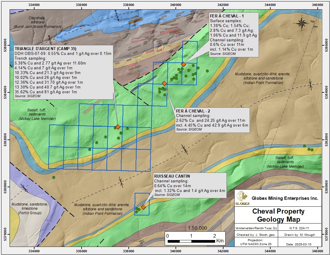
Copper mineralization include native copper, bornite, cuprite, chalcocite, chalcopyrite and malachite and occurs within quartz-carbonate veins cutting intermediate to mafic lavas (Fer à Cheval, Triangle d’Argent) or conglomerates (Ruisseau Cantin).
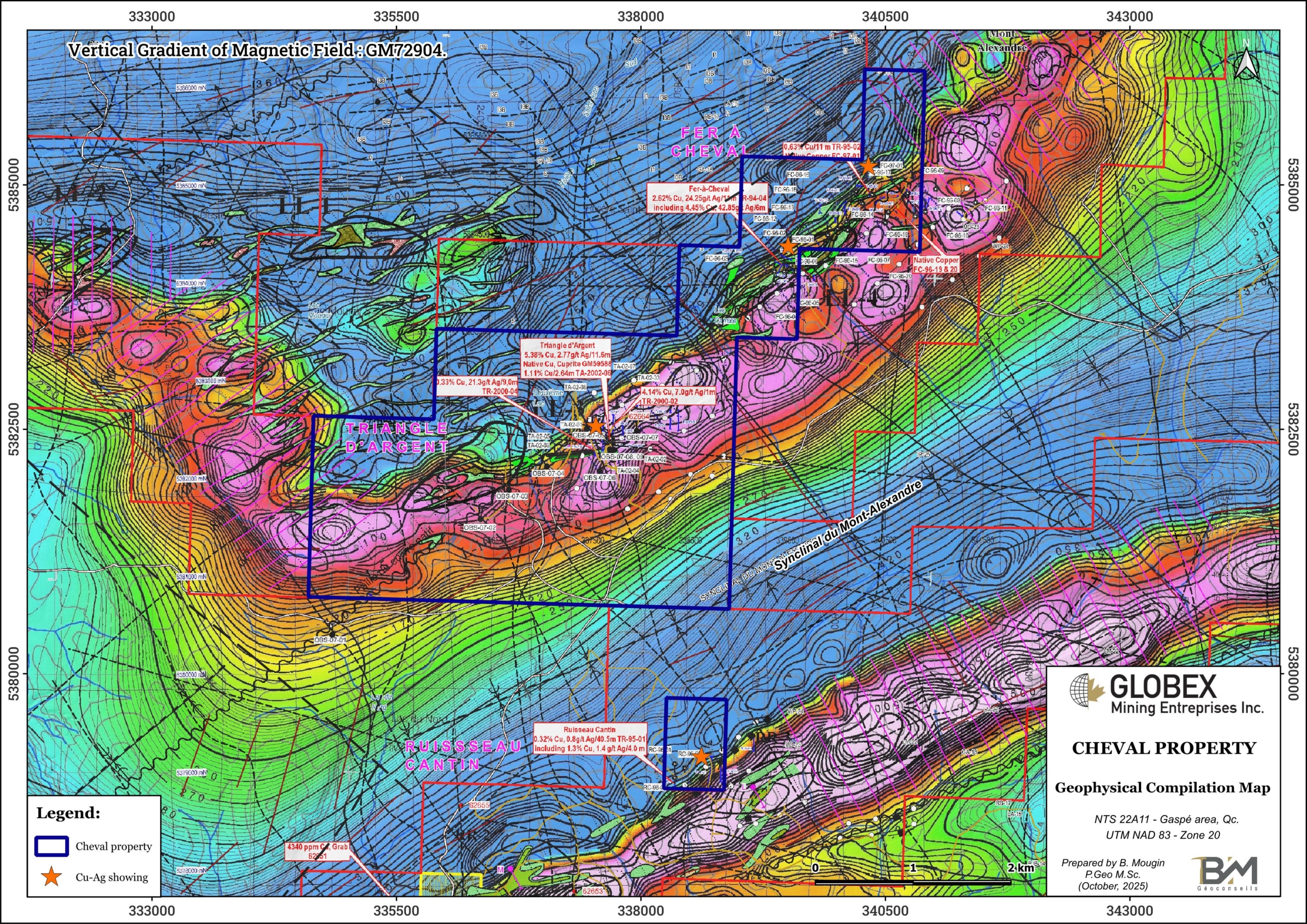
The Cheval property area hosts four (4) Cu-Ag showings discovered by prospection and trenching between 1995 and 1997. Historical channel-sampling returned assays up to 4.45% Cu and 42.9 g/t Ag over 6 m on the Fer à Cheval 2 showing (GM56982), and 5.38% Cu and 2.77 g/t Ag over 11.60 m on the Triangle d’Argent showing (GM59588).
History
First serious work in the area date back from the mid 70s with Noranda and Gaspé Mines carrying out detailed geological mapping, geophysics, geochemistry and shallow diamond drilling (DDH). During the 90s, Exploration Raudin undertook ground geophysics (Mag, EM and IP) and soil sampling which helped to define targets for both trenching and DDH in the area of the Fer à Cheval showings ; channel-sampling intersected up to 2.62% Cu and 24.25 g/t Ag over 11 m (GM56835). More exhaustive compilation of historical work on the Cheval property is proposed in Bussières (2021, GM72904).
In recent years, Metco Resources Inc. (2006-2007) and Breakwater Resources Inc. (2008-2010) successively carried out compilation, interpretation of satellite images, geological mapping, re-logging of DDH core, as well as new DDH and soil geochemistry.
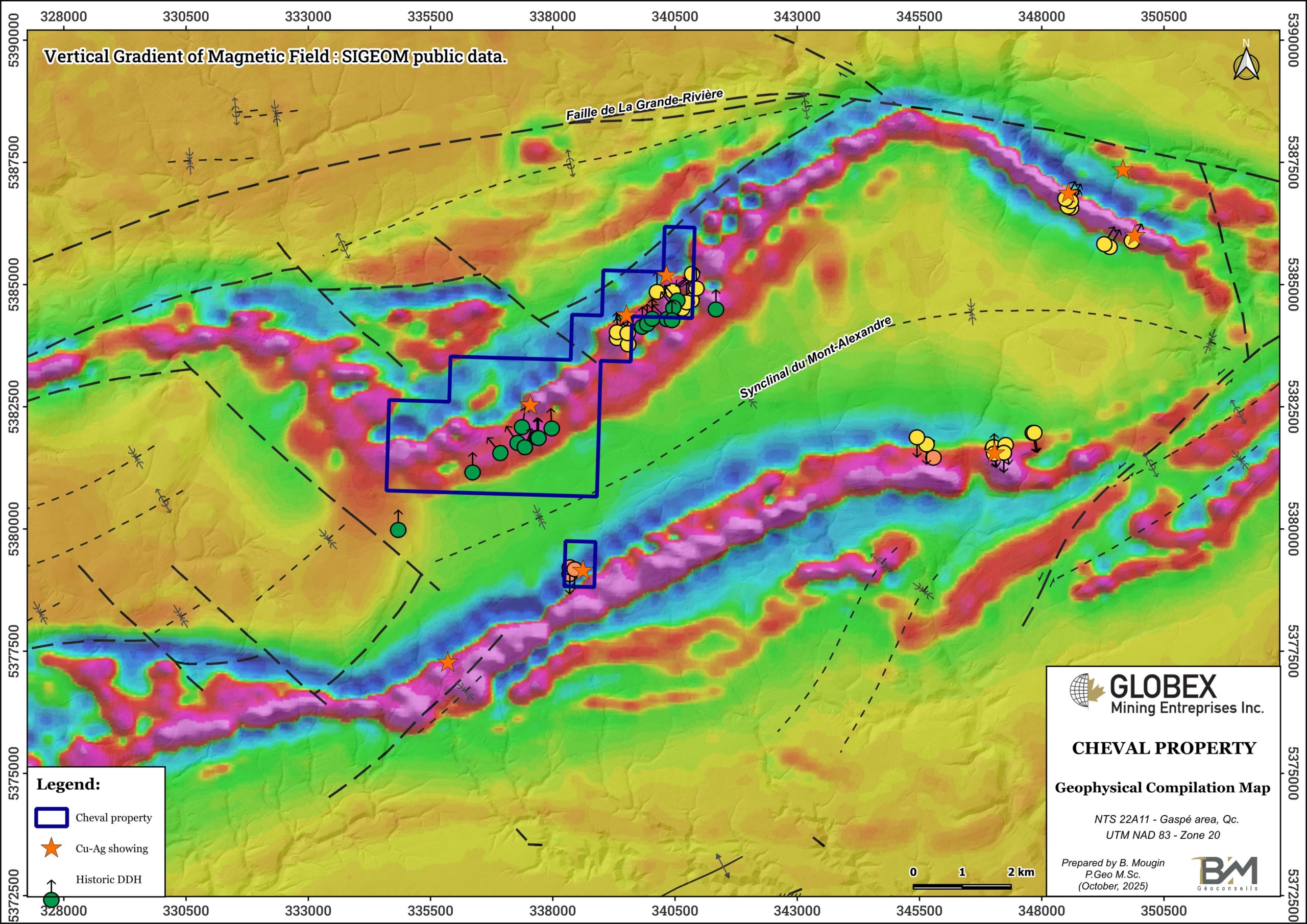
In 2021-2022, 1844 Resources Inc. undertook new geophysical and soil geochemistry surveys (GM72977). A high-resolution heliborne magnetic survey covered the entire area of the property in 2022 (GM72976).
Resources and Potential
Historical work succeeded in defining a favorable geological context for Cu-Ag mineralization in the area of the Cheval property. It was noted in the bibliography that the Triangle d’Argent, Fer à Cheval and several other showings were located along a longitudinal stratigraphic fault called the “Native Copper Fault” which appears to be the most significant mineralized structure of the area (GM72904).
All historical geoscientific data should be compiled in a GIS project in order to verify if any concordant Mag / EM / IP / soil anomalies have been properly checked by prospection, trenching or diamond drilling. If not, new field work is strongly required.