La Reine
Location, Access, Description
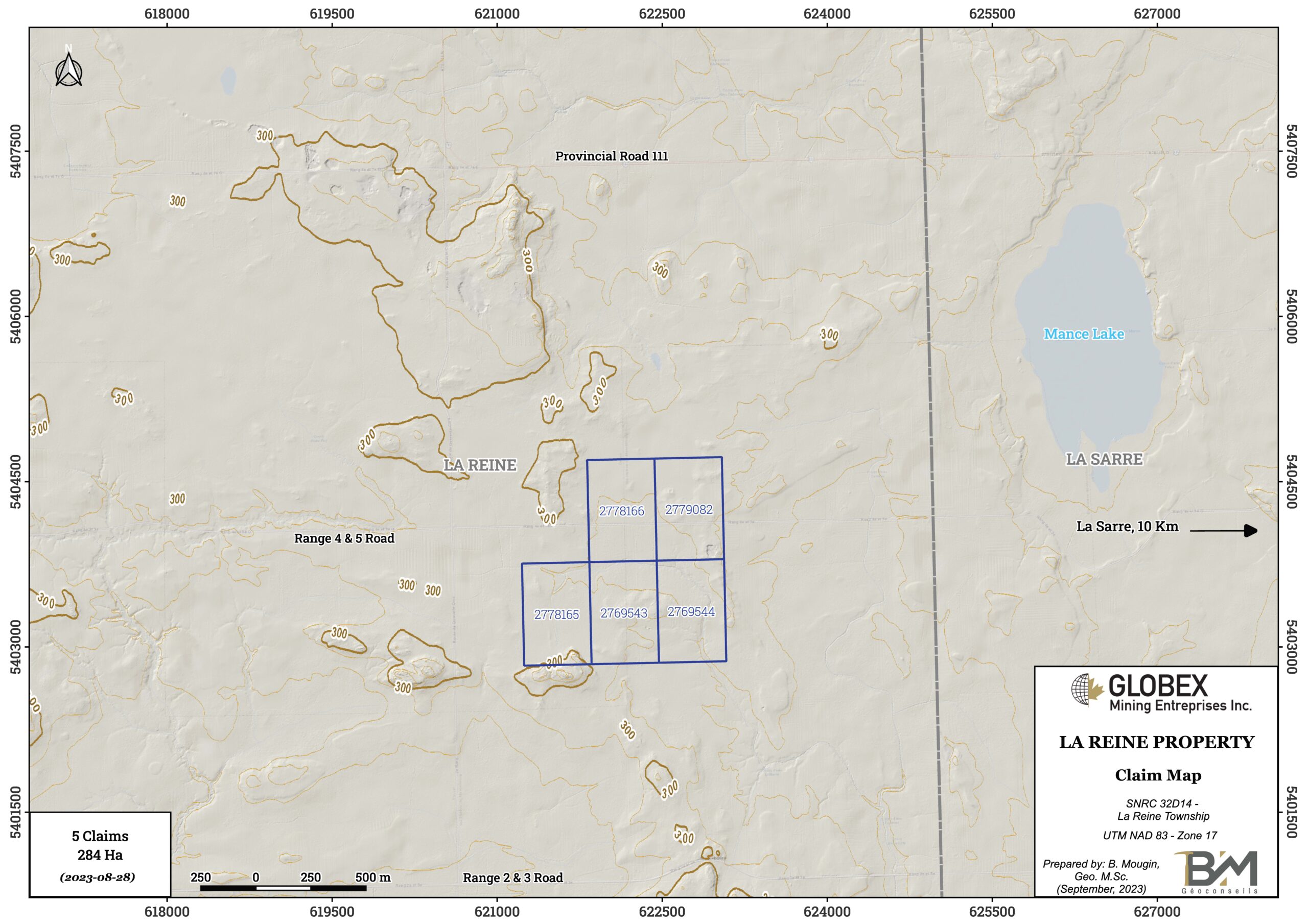
The La Reine property is located in Abitibi (Quebec Province) around 10 km west of La Sarre and 65 km northwest from Rouyn-Noranda. It consists of 5 contiguous mining claims totaling 284 Ha in La Reine township (NTS 32D14). The claims are wholly owned by Globex and are not subject to any underlying royalties or third party interests.
Topography of that area is quite flat and locally swampy due to the presence of the Maine river, Mance lake, as well as several streams. Elevations are comprised between 290 m and 300 m above sea level with not much outcrops on the La Reine property.
The property is accessible by car, driving on road 111 North from La Sarre, then turning on the Range 4 & 5 road toward west. A network of trails then allows to move easily by walk or VTT within the property.
Geology and Mineralization
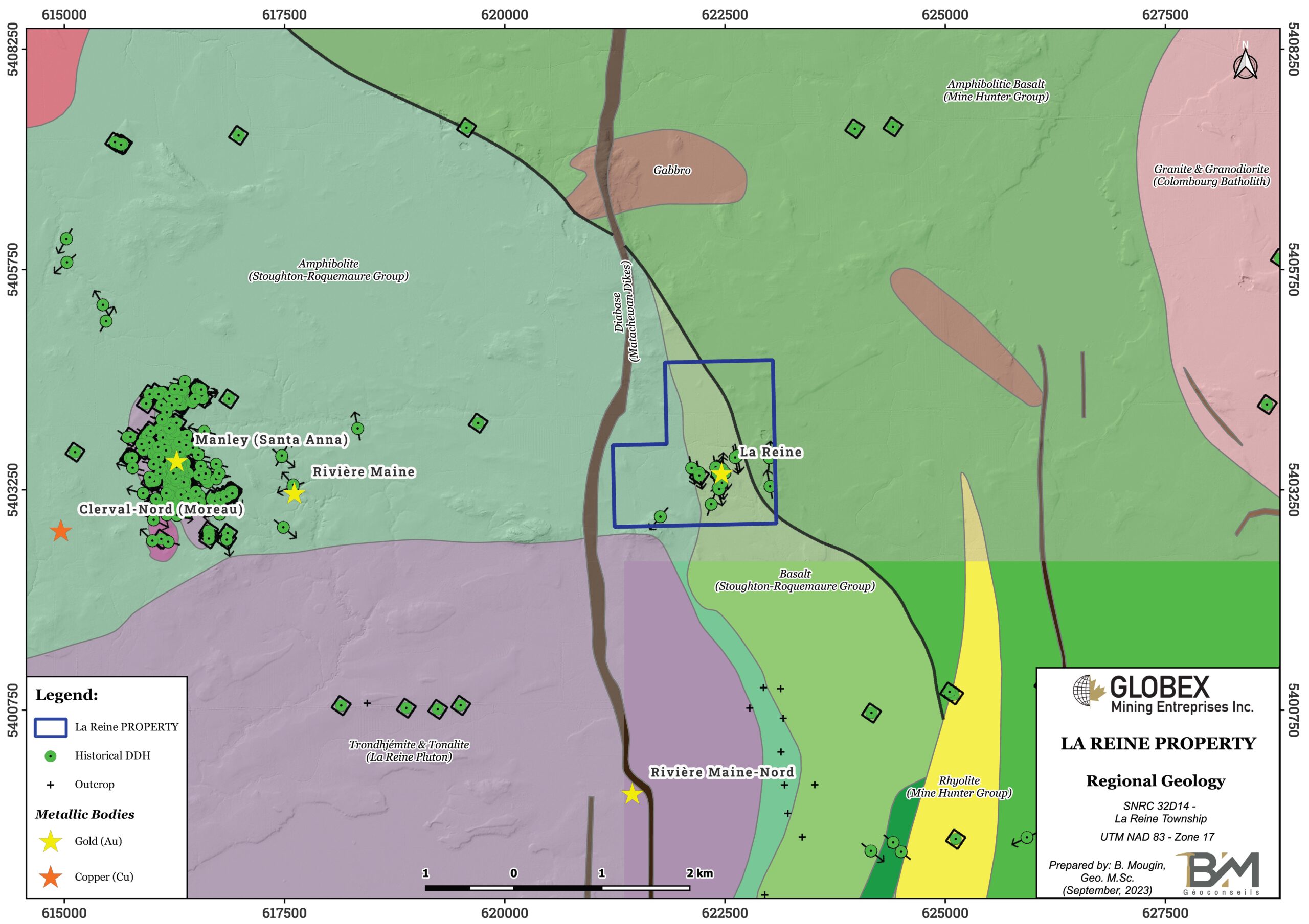
The La Reine property is located in the Northern Volcanic Zone of the Abitibi Greenstone Belt of the Canadian Shield (Chown et al, 1992). Rocks of that area are represented by archean felsic to mafic volcanics and tuffs of Hunter Mine Group (HMG) and intermediate to mafic volcanics and tuffs of Stoughton-Roquemaure Group (SRG) as well as numerous intrusions of tonalite, trondhjemite and granodiorite (TTG), diorite, gabbro and diabase. Dostal and Mueller (1996) indicate that rocks of the SRG conformably overlie those of the HMG, whereas Hocq (DV89-04) indicates a faulted contact between the HMG and SRG. The HMG is separated to the north from Amos Group volcanics by the Macamic fault. The Palmarolle, Poularies, Dupuy and Colombourg intrusions cut the Hunter Mine volcanics east of the La Reine property, while La Reine Pluton and Lac Abitibi-Okikodesik Batholith intrude the Stoughton-Roquemaure volcanics west and south of the property. Each of these intrusions are interpreted as being syntectonic (MB95-39).
The region was affected by two deformation events. In the area of the property, D1 formed folds with an E-W axial plane such as the Lake Abitibi Anticline and a main E-W schistosity while D2 formed large zones of ductile dextral strike-slip faults oriented generally NNW-SSE to WNW-ESE (GM55470). These faults as well as the syntectonic plutons have disrupted the orientation of the main schistosity.
The geology of the property is made up of greenschist-facies andesites and gabbros intruded by a small granodiorite pluton, which is thought to be an extension of the larger La Reine pluton to the south. The pluton is invaded by a series of east-west trending, vertically dipping quartz ±barite veins, which are mineralized with disseminated to massive pyrite and molybdenite, as well as small concentrations of gold.
Molybdenum-gold mineralization hosted within quartz ±barite veins was recognized in that area. On the La Reine showing, surface mineralization consists of massive to finely-disseminated pyrite, veinlets and disseminations of molybdenite in a granodiorite of the La Reine Batholith. The veins are from 10 cm to 1.5 m wide, and some are continuous in surface outcrop for up to 50 m and may be the near-surface expression of a more extensive stockwork of veins at depth, as historical diamond drilling holes (DDH) intersected over 100 m of quartz ±barite veinlets, some with disseminated MoS2 and disseminated to massive pyrite. Silica, Ankerite and hematite alteration is frequently observed in the hostrock at the veins contacts.
The 1937 report issued by La Reine Gold Mines, Ltd. (GM07412-A) describes five major veins on the property, from south to north, as follows :
- Vein no. 1 has the highest grades. It strikes 266° and dips 82°N, is over one metre wide and exposed along its length for 47 metres, and contains 20% pyrite and locally massive molybdenite;
- Vein no. 2 strikes 269° and dips 86°N. It is 0.5 m wide and exposed over 40 m, and contains 10% pyrite and a 3 cm vein of molybdenite ;
- Vein no. 3 ranges in thickness from 1.5 m at its eastern extremity to 20 cm at a point 30 m to the west. It strikes 270° and dips 80°S, and is composed of quartz and aplite in roughly equal amounts. Mineralization consists of 30 to 50% pyrite and disseminated molybdenite ;
- Vein no. 4 has a maximum width of 1.7 m and is exposed for about 15 m along strike. The strike is 270° and the dip is 75°N. The vein consists of quartz, 15% pyrite, and disseminated molybdenite ;
- Vein no. 5 is 0.6 m, wide and exposed for a length of 45 m. It strikes 273° and dips vertically. The vein is composed of quartz, 10% pyrite, and disseminated molybdenite.
Historical DDH assays graded up to 11 g/t Au over 0.30 m (GM39223).
History
Claim activity on the La Reine property commenced on May 5, 1936, when La Reine Gold Mines, Ltd. staked a block of twelve lots in range IV, (GM07780). The company carried out 1500 m of stripping and 600 m of trenching with an average of 1.5 m depth (GM07412-A). They also sunk an exploration shaft as well as 17 DDH for a total of 1,800 m, near the primary showings.
Further work on the property was conducted in 1958 by N. Aubé Claims, who localized previous workings and dug an unspecified number of new pits on the east side of the main showings. Of four samples analysed by this company, one contained 0.012 oz/ton Au and 0.51% Mo (GM07304).
In 1960, J.M. Yates Claims sunk five diamond drill holes (DDH 2-6), then in 1965, dug new surface workings (GM17428, 17796, 18715, 19388, 19455, 20983, 22094) and created a detailed map of all surface workings (trenches, pits, shaft, tailings dump), mineralized veins and assay results (GM17446). Molybdenite grades ranged from 2 to 6%, and gold grades ranged from 0.02 to 1.69 oz/ton. Four zones of mineralization were identified to that point.
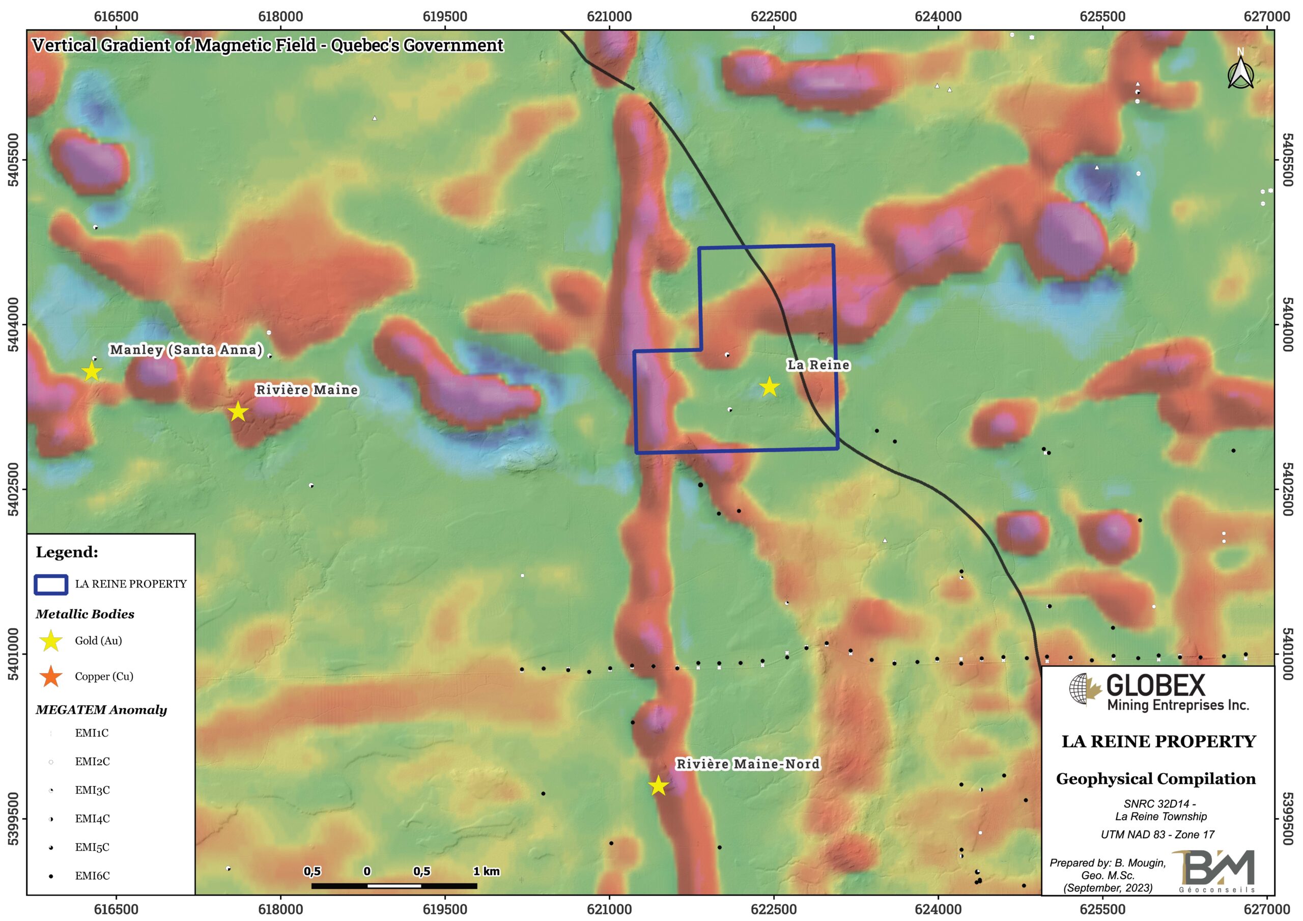
In 1968, the Noranda Exploration Company, Ltd. conducted magnetic (MAG) and electromagnetic (EM) surveys of the property which revealed a few metallic conductors.
In 1980, Eastern Mines Ltd. carried out a VLF-survey which highlighted several strong conductors that were tested by DDH in 1982 ; DDH E-3 intersected 1.05% MoS2and 0.01 oz/ton Au over 0.4 m. Vein no. 1 was intersected by DDH E-6, and graded 1.66% MoS2, 0.02 oz/ton Au and 0.54 oz/ton Ag over 0.4 m. DDH E-7 intersected 100 m of variably mineralized quartz veins grading up to 15.95% barite over 0.3 m.
In 2007 and 2008, Radisson Mining Resources carried out detailed sampling on the mineralized showings as well as 56 km of line-cutting in order to produce a detailed geological map of the property. Disappointing results led the company to abandon the claims (GM64226).
Resources and Potential
No resource estimation has ever been calculated on the La Reine property. The Santa Anna deposit, located 6 km west of the property, hosts a non 43-101 compliant resource estimated to 330,960 metric tonnes at a grade of 3.07 g/t Au, based on a mineralized thickness of 2 m, and 356,721 metric tonnes at a grade of 2.42 g /t Au, based on blocks with a minimum thickness of 5 m (GM56171, 1998). This property is also 100% owned by Globex.
Less than 15 km north of the property is the former Duvan mine which produced 1,052 tonnes at 11.99% Cu and 100.80 g/t Ag in 1960. Non-43-101 resources are estimated at 101,000 tonnes grading 2.50% Cu (MB98-06). This property is also 100% owned by Globex.


