
Lac Canoe
Location, Access, Description
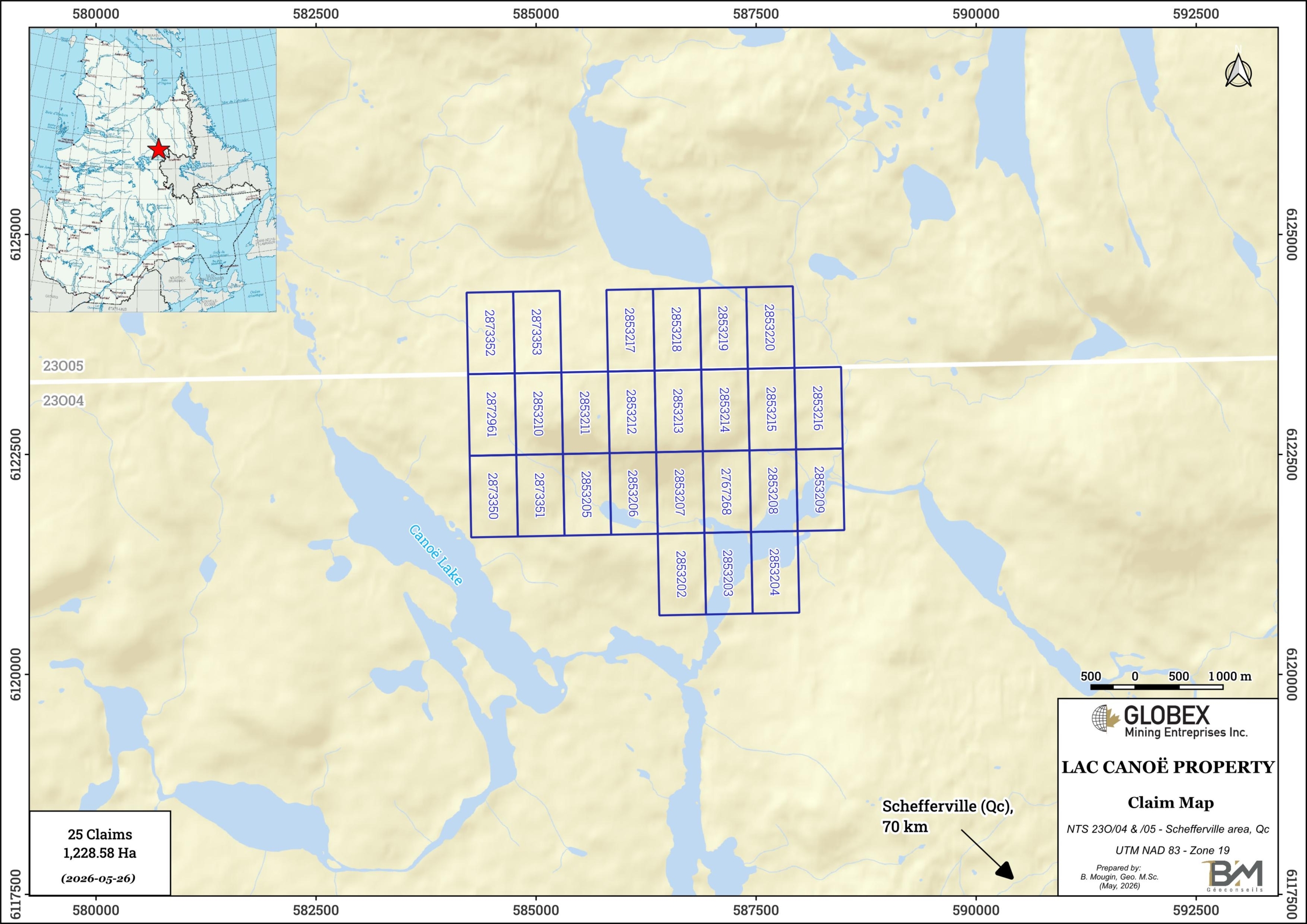
The Lac Canoe property is located in the Nunavik Territory, MRC of Kativik, in Nord-du-Québec region, about 70 km NW of Schefferville. The property consists of 25 mining claims totaling 1,228.58 Ha in NTS 23O04 & 23O05. Globex is 100% owner of the property which is not subject to any third-party interests.
The property is located on public lands where exploration is allowed without specific restrictions. The only way to access the Lac Canoe property is by helicopter or seaplane since no road links between Nunavik and southern Quebec.
Geology and Mineralization
Regional Settings
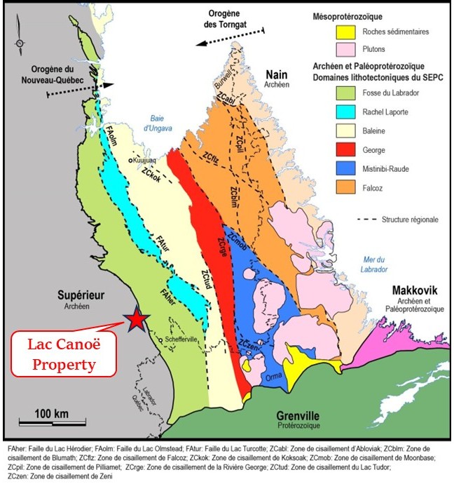
The property is located in the Ashuanipi Subprovince of the Superior Province of the Canadian Shield, near the contact the Churchill Province to the east (Figure 2). The Ashuanipi Subprovince is an Archean domain of high metamorphic grade consisting of ancient units (<2725 to 2680 Ma) of metasedimentary rocks, volcanic rocks, tonalitic and granodioritic intrusions, and, to a lesser extent, mafic to ultramafic rocks. The ancient units are cut by voluminous masses of diatexite (2680 to 2660 Ma) which are the product of the partial melting of the ancient units, mainly paragneiss.
Property Geology
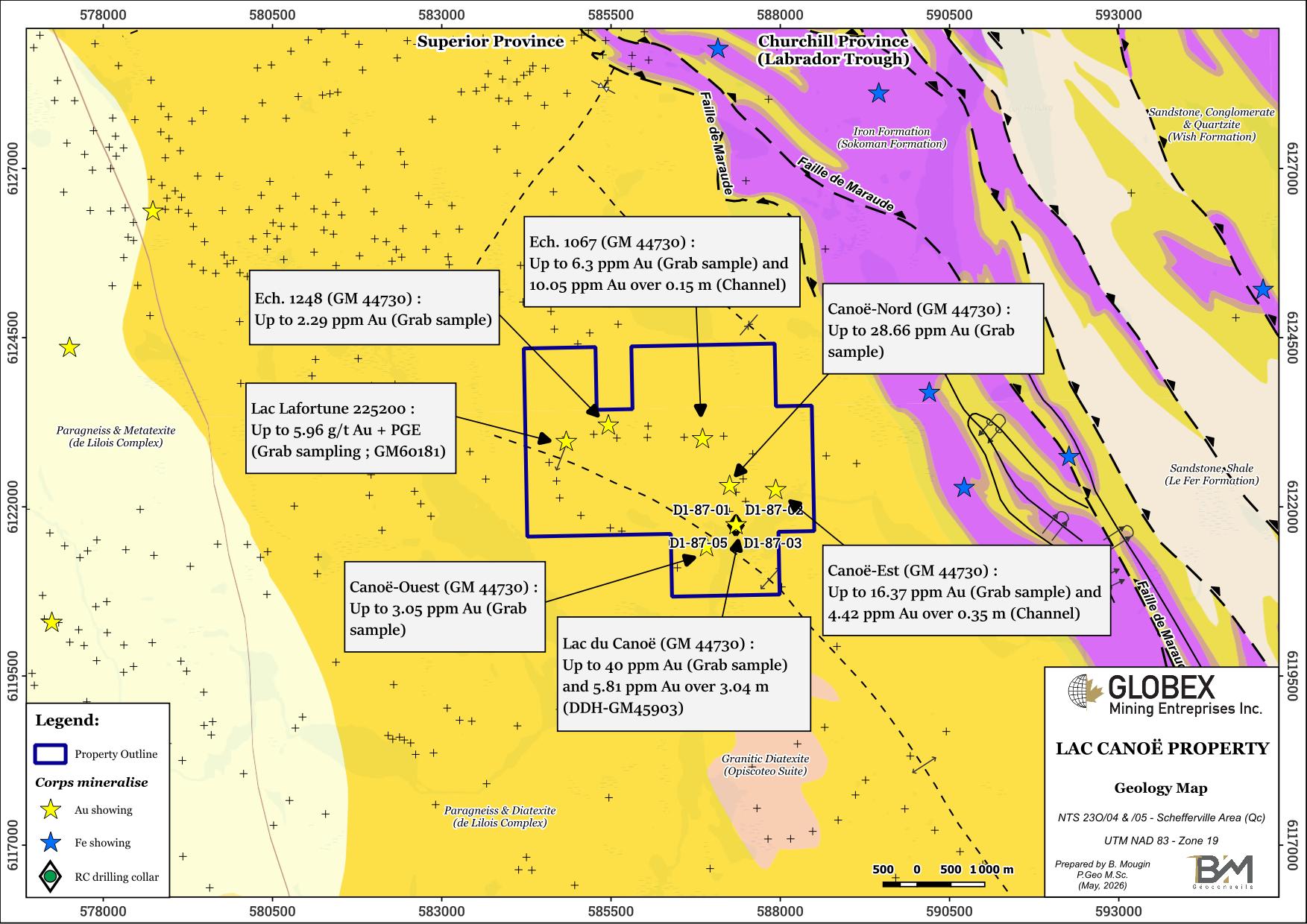
The Lac Canoeproperty is composed of migmatitic paragneiss with biotite-garnet ± pyroxene with 33% to 66% of leucosome suggesting a moderate to strong intensity of partial melting (Lapointe, 1986, 1989; Chevé and Brouillette, 1988, 1990, 1992). The mesosome (paragneiss) is generally well foliated, gray to dark gray. In addition to garnet, the mesosome is composed of plagioclase (25 to 55%), more locally microcline (<5 to 10%), quartz (30 to 40%) and ferromagnesian minerals (20 to 30%) dominated by biotite. Amphibole (hornblende) and/or pyroxene are observed incidentally.
Several thrusts and folds concordant to the regional foliation are recognized in the property area.
Regional Metallogeny
As for Clark and Wares (2004), metallic deposits known in the Labrador Trough area include 1) Stratiform copper sulfide deposits located in the dolomites of the early platform stage ; 2) A few sedimentary uranium deposits were formed in sandstones and siltstones that accumulated during the rifting event, particularly in the Early Proterozoic outliers located west of the orogen in the Superior Province ; 3) Lake Superior-type iron formation precipitated during the early platform stage of the second cycle 4) Algoma-type iron formation and associated VMS deposits originated in deeper water in an adjacent basin that was coeval with this platform ; 5) Magmatic Cu-Ni-PGE deposits, hosted mainly in mafic sills and locally in picritic lava flows, formed at the beginning of the mafic volcanic episode ending the second cycle ; 6) A large carbonatite intrusion emplaced late in the second cycle contains concentrations of Nb-Ta-REE.
Hydrothermal fluids generated during the Hudsonian Orogeny (1.82-1.77 Ga) are believed to have remobilized preexisting deposits, resulting in the formation of a variety of epigenetic base- and precious-metal deposits. Locally, these deposits are spatially associated with regional or local faults.
Property Mineralization
The Lac Canoe property hosts seven (7) gold showings which all have been discovered by prospection between 1985 and 1987 by Vior-Mazarin. Mineralization is predominantly stratiform hosted in paragneiss (Lac du Canoe) and banded iron formations (all other showings). Mineralization is composed of traces to 50% (most of the time 3-5%) of disseminated pyrrhotite ±arsenopyrite ±pyrite ±chalcopyrite and forms discontinued and boudinated sulphide lenses concordant to the regional foliation.
Historical work mention assays up to 40 g/t Au on grab samples and 5.81% Au over 3.05 m in DDH on the Lac du Canoe showing (GM 45903).
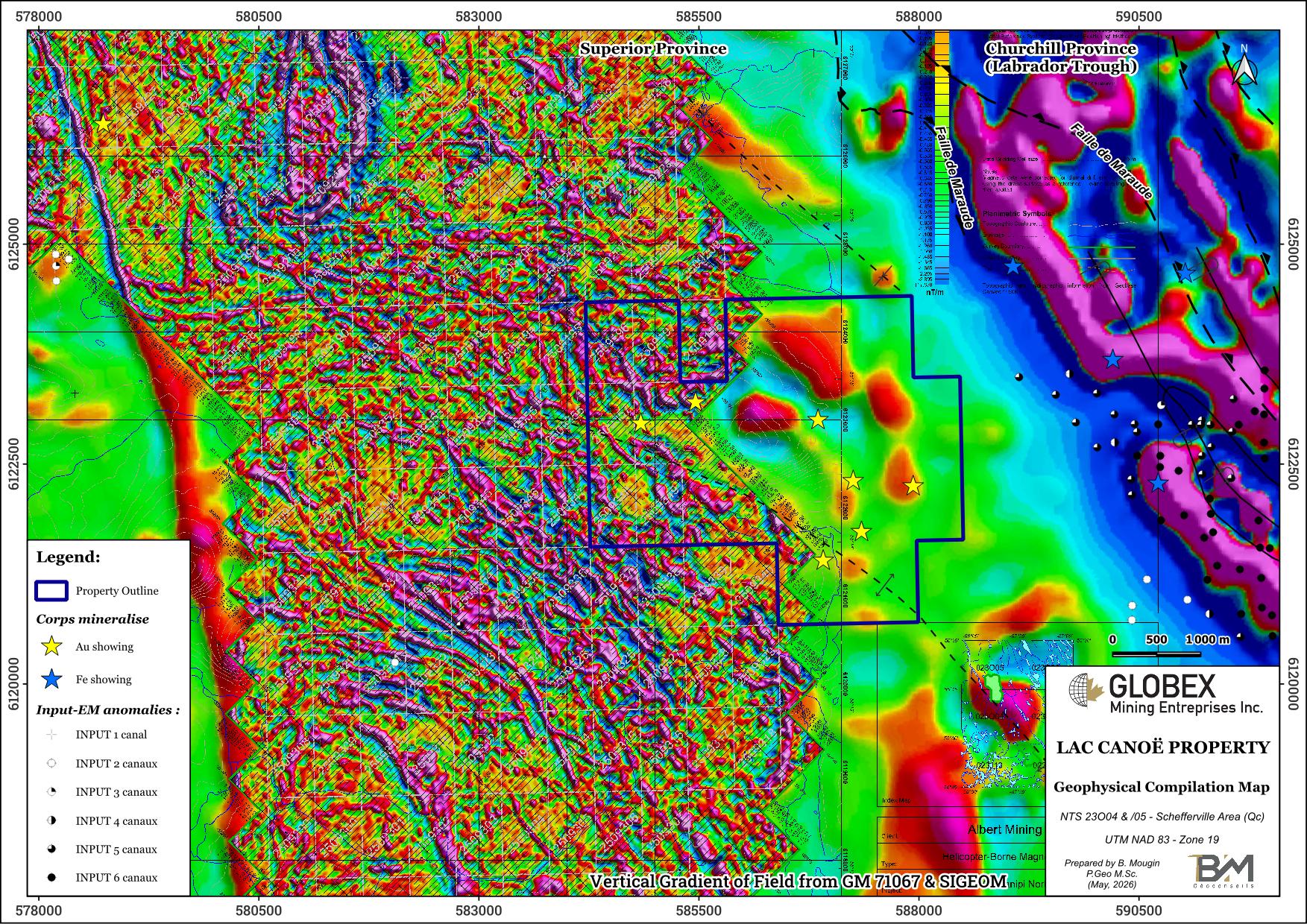
Known showings on and out of the property in this area don’t particularly appear to be associated with magnetic anomalies.
History
The Geological Survey of Canada first carried out expeditions in the area of the Lac Canoe property between 1892 and 1895. Very few exploration has been undertaken in the area before the 1980s, most of the work was concentrated on iron mineralization in the Labrador Trough to the east.
During the 1980s to 2000s, Quebec Government conducted several regional exploration programs including gravity (DP 84-46), lake sediments geochemistry (MB 84-07, DP 86-23, MB 88-36), EM and spectrometry (DP 87-04), followed by regional geological and metallogenic surveys (MM 95-01, MM 2004-01, EP 2012-01, MM 2015-01) , geochronology (MB 2011-04) and high-resolution airborne magnetometry (DP 2013-02, DP 2017-06).
Of exploration work by private mining companied, we can cite those of Vior-Mazarin which during late 1980s carried out magnetic and VLF-EM surveys, prospection and channel-sampling (GM44730), as well as a 5-holes shallow geochemical (RC) drilling program (GM45903). This work led to the discovery of the seven (7) Au showings listed on the Lac Canoe property. More recently, Albert Mining inc. carried out in 2018 a High-Resolution heliborne magnetic survey (GM 71067 and GM 71068) followed in 2019 by a Computer Aided Resource Detection System (CARDS) to evaluate and target the gold potential over its Ashuanipi Property (GM 71172) which englobed the western part of the Lac Canoe property of Globex.
Resources and Potential
Due to very few historical exploration work by private mining compagnies, the true gold potential of the Lac Canoe property is still to be discovered. Only five (5) vertical DDH have been drilled on the property, all of them concentrated on the Lac du Canoe showing. The main difficulty lies in the discontinuous nature of mineralization due to boudinage deformation of the rocks.
As gold is generally associated with up to 50% sulphides on the known showings, induced polarization (IP) surveys appear to be a well appropriated indirect method to highlight new mineralization in surface. GIS compilation of historical geoscientific data should help to further explore the known showings and plan new geophysics, strippings and DDH.