Lac Edgar
Location, Access, Description
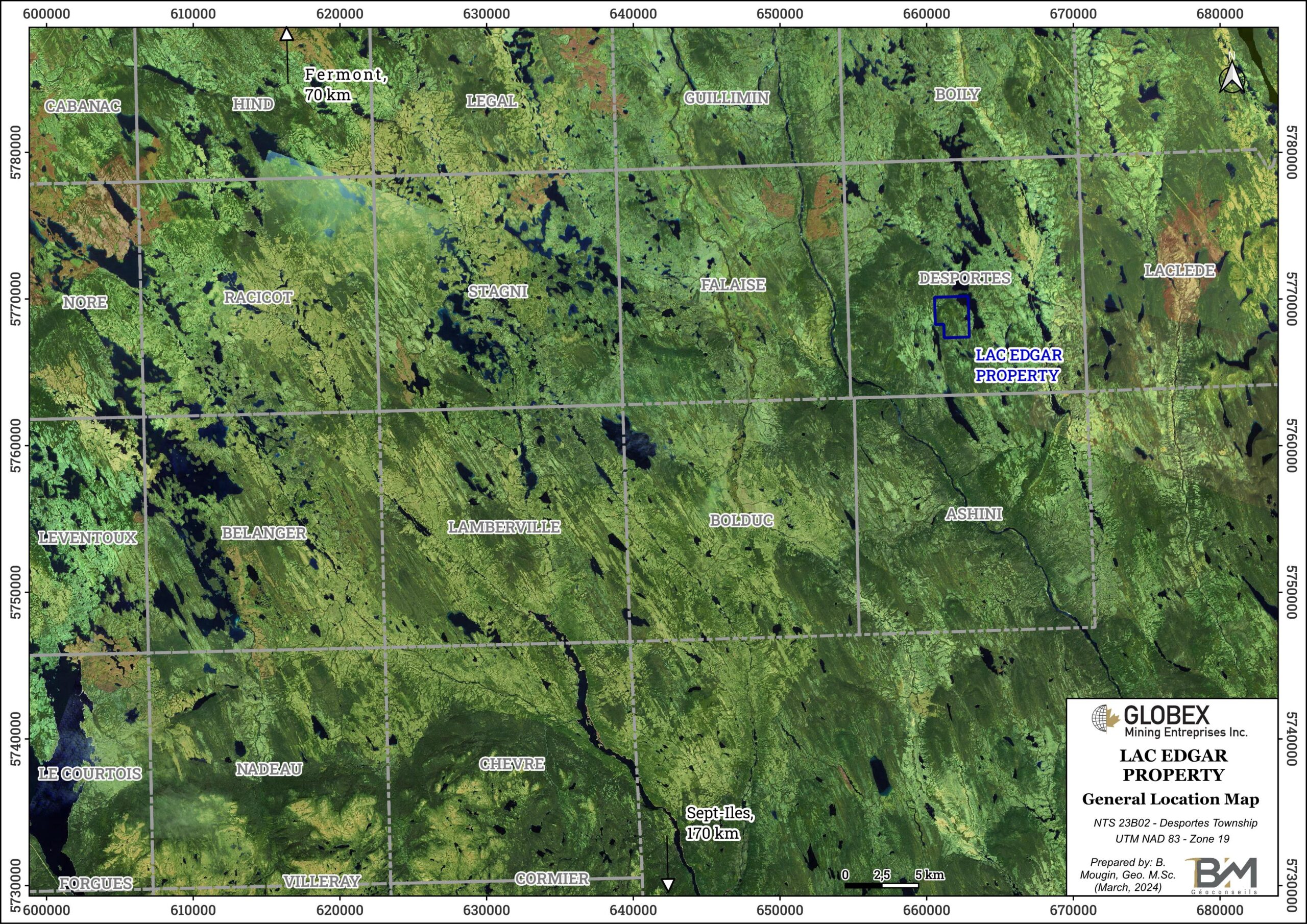
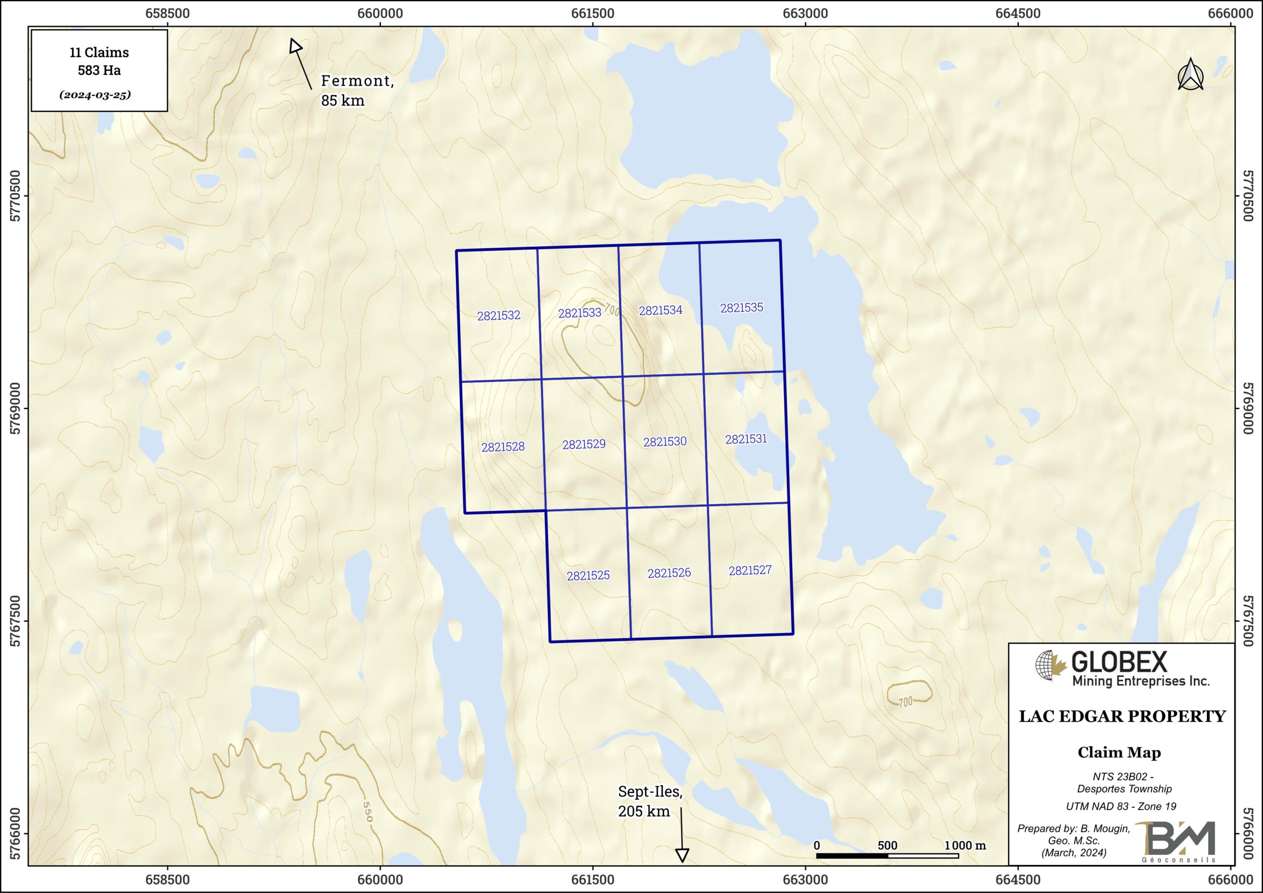
The Lac Edgar property is composed of 11 contiguous mining claims covering an area of 583 hectares in the Township of Desportes, in the Côte Nord Administrative Region of Quebec (NTS: 23B02). The property is located about 90 kilometres south-east of the town of Fermont (Qc) and 200 kilometres north of the town of Sept-Îles (Qc). The claims are wholly owned by Globex and are not subject to any underlying royalties or third party interests.
The property is located between Edgar and Sarah lakes, and it is centered on two NW-SE gently rolling hills that rise at 740 metres above sea level. Top of these hills are covered with mature forest of black spruce, and not much outcrop is observable since most of the property is covered with a thin veneer of glacial till. The Edgar lake occupies the NE part of the property with an elevation of 630 metres above sea level. This area is the swampiest.
The Area lacks infrastructure and the nearest road is 55 kilometres away. Access is by float plane to Sarah or Edgar Lake or helicopter. A power line to Labrador City passes about 20 kilometres to the northeast and a road some 55 kilometres to the northwest. Much of the overburden is moraine and glacial fluviatile deposits which will assist in any road construction. Wabush-Labrador City, located 120 kilometres to the north, is the nearest community with basic support for exploration and regional airport.
Geology and Mineralization
Regional Settings
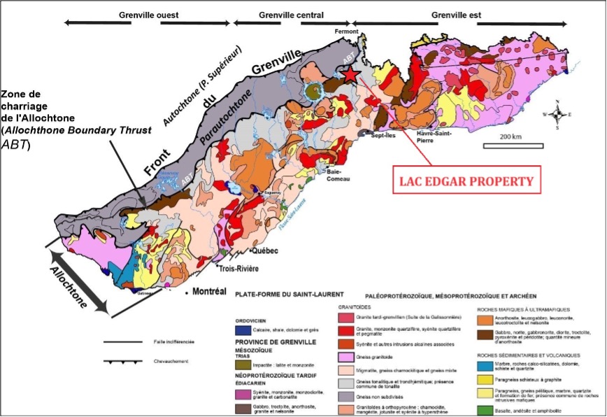
The area of lake Edgar was mapped in 1975 by Quebec MERN (RG 162). It is located in the Allochtone part of the Grenville Province which is separated from the Parautochtone by the Grenville Front, a fractured and mylonitized zone which testifies to the transition from a fragile deformation to a ductile deformation in the direction of the orogen. The Grenville Orogeny, with dates of 950 ± 150 Ma, represents the last metamorphic episode affecting the rocks of the region.
The Allochtone is composed of paleoproterozoic to mesoproterozoic rocks (1.6 to 0.985 Ga) which were metamorphosed to the upper amphibolitic to granulites grades during the Grenvillian orogenesis. In its western part, it is formed mainly of marble, quartzite and pelite horizons, and mesoproterozoic age amphibolites. It is also composed of charnockitic and anorthositic intrusions that intersect metasediments and orthogneiss. In the centre, migmatites, quartz-feldspar orthogneiss and mangerites predominate. In its eastern part, it is formed mainly of gneissic rocks of varied composition and origin, metasedimentary rocks, granitoid intrusions, gabbro, gabbronorite and anorthosite. Also, several anorthositic intrusions are scattered throughout the Allochtone belt.
The Parautochtone is composed of Archean rocks older than 2.5 Ga and Proterozoic rocks. These are plutonic supracrustal rocks (metasedimentary and metavolcanic) very deformed and metamorphosed to the the greenschists grade to that of granulites during the Grenvillian orogenesis. These rocks are correlated with those less deformed of the Superior Province north of the Grenville Front and correspond to their lateral extension of east-west orientation.
Property Geology & Mineralization
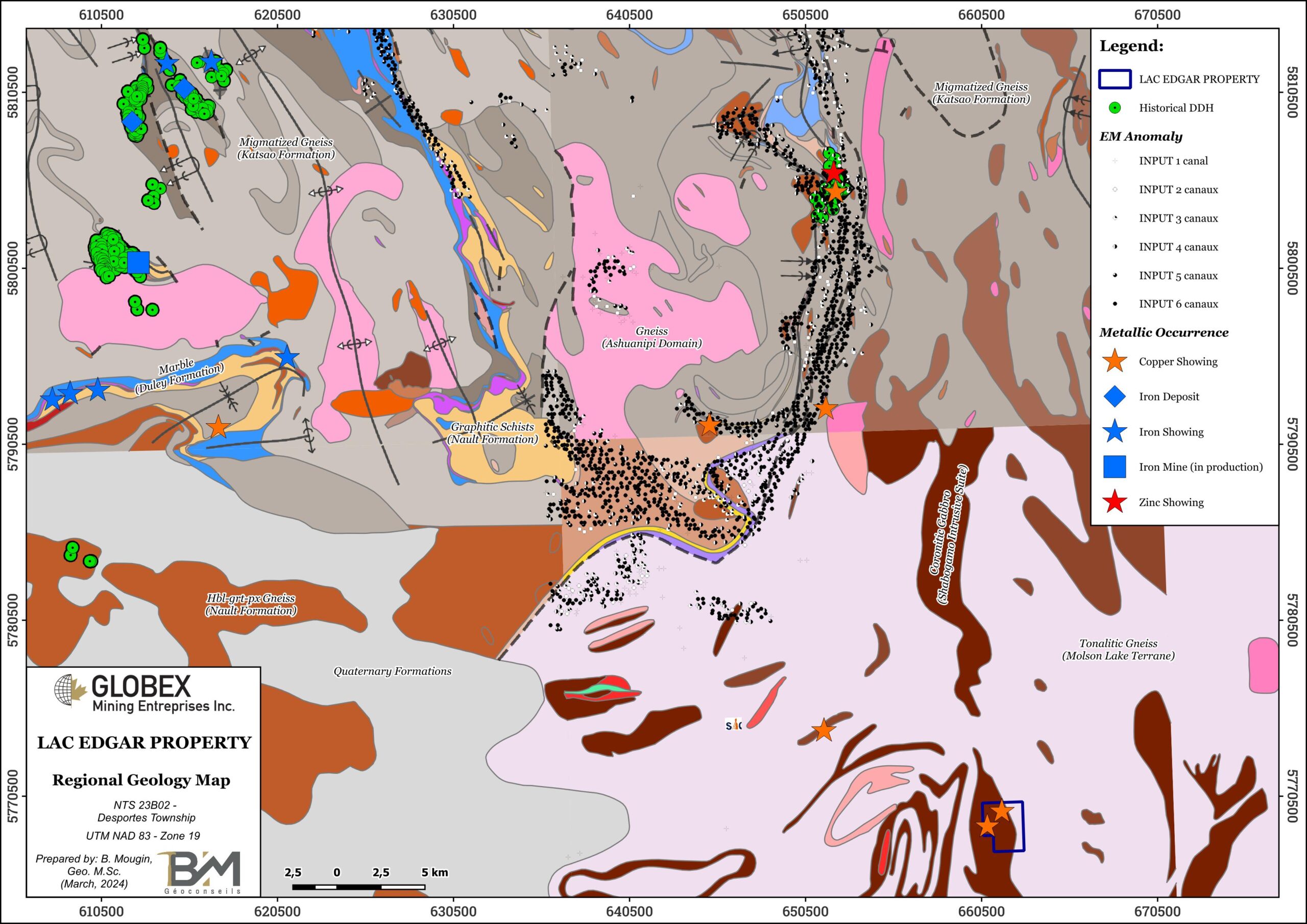
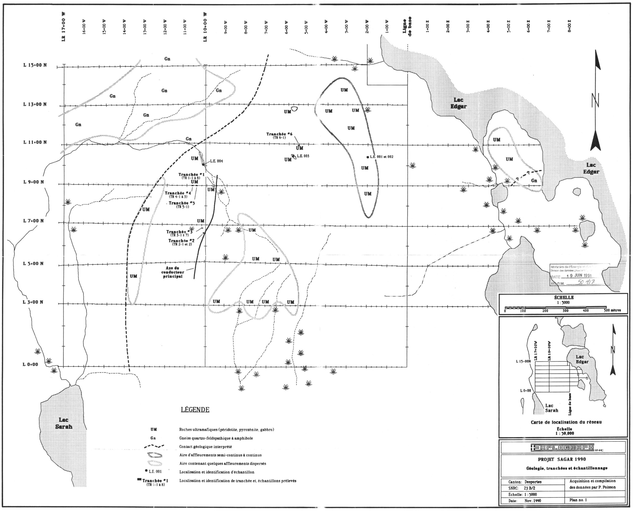
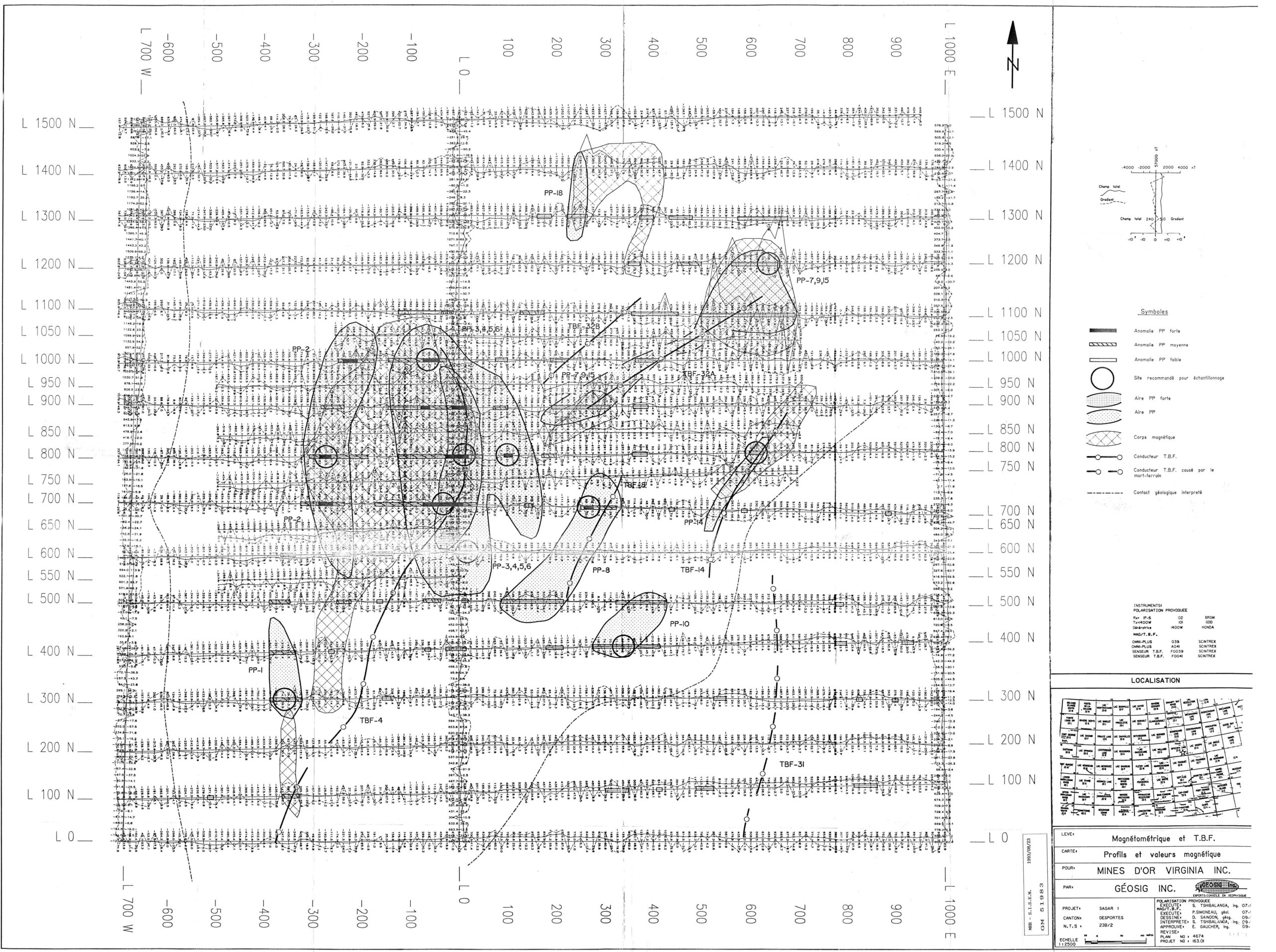
The area of the property is composed of gneiss in which take place mafic to ultramafic intrusions as well as some metamorphosed granite intrusions. The dominant lithology is a gray gneiss composed mainly of feldspar and quartz with varying amounts of biotite and/or amphibole (GM 51983). A second gneiss facies is also observed occasionally ; this rock is more massive and homogeneous, and relatively poor in ferromagnesian minerals. Gneiss is intersected by mafic to ultramafic intrusions. Occasionally, gneiss and peridotite are intersected by granitic veins of centimetric to metric thickness, sometimes with pegmatitic texture (GM 50417).
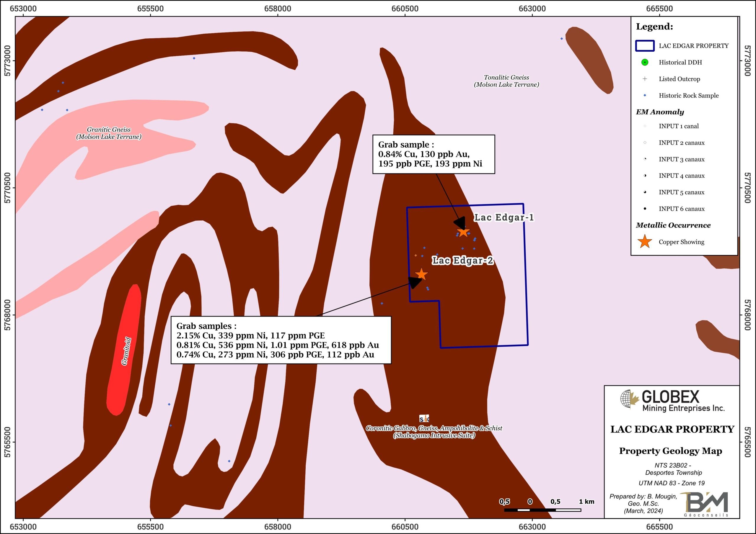
Both hills southwest of Edgar Lake consist of ultramafic (UM) rocks that lie on top of the granite gneisses. Layers of gabbro, olivine gabbro, peridotite to pyroxenite have been identified (GM 51983), but generally these UM rocks consist of two rock types : 1) a fine-grained sugary looking peridotite that is made up predominantly of dark green olivine ; 2) a similar rock that contains 2 to 3 mm grains of pyroxene or amphibole in a finer grained matrix. The diameter of the intrusion is roughly 2 km by 2 km in NW-SE orientation, steeply dipping about -70° toward west. Contact is interfingered with the surrounding gneiss (GM 54424). Neither the gneiss nor the ultramafic intrusion exhibit much visible post emplacement deformation.
Field observations suggest that UM rocks are amphibolitized and thus highly metamorphosed similar to the underlying granite gneisses (GM 64646). Previous writers have interpreted UM rocks as intrusive but they may well be a metamorphosed sequence of ultramafic volcanic rocks which were part of the pre-metamorphic geologic cycle.
According to historical works, there are two areas carrying copper-nickel mineralization within the UM and both lie near the margins of the unit near its contacts with the underlying gneisses (GM 64646). Sulfide mineralization including pyrrhotite, pyrite, chalcopyrite and pentlandite up to 5%. Sulfides appear to have precipitated at the same time as the crystallization of the rock forming minerals, thus this could be considered an orthomagmatic deposit. The sulfides in this case are disseminated and Diadem’s drill core suggests that most of the copper mineralization is associated with the olivine-rich phase (GM 54424).
History
During the late 60’s, Franconi et al. from Quebec MERN mapped the area of the property and set-up the regional geology and metallogeny context (RG 162).
In 1987-1989, the Quebec Department of Mines and Energy conducted a petrology and metallogeny study on mafic and UM rocks southeast of Fermont (ET 91-01). Grab samples taken from the Edgar Lake intrusion returned up to 0.84% Cu (Edgar Lake 1 showing).
Between 1990 and 1992, Explograph and Virginia Gold Mines jointly undertook geological mapping, grab sampling, line-cutting, Mag, MaxMin, IP and EM-VLF ground surveying, soil geochemistry, rock stripping and channel sampling on the Sagar property located between Sarah and Edgar lakes (GM 50417 and GM 51983). These works highlighted several coincident anomalies locally associated with disseminated sulphide mineralisation (Cu ±Ni, ±Au, ±Pt and ±Pd) but the highest IP and VLF anomalies could not be exposed by stripping because of the thickness of overburden. The Edgar Lake 2 showing (2.15% Cu on a grab sample) was discovered in a trench during this work (GM 50417). Virginia also drilled a few DDH but no record or drill logs remain to show hole numbers, locations directions or dips.
Virginia then dropped the property which was picked up by Diadem who carried-out in 1995-1996 new mapping and sampling of the UM intrusion, as well as re-sampling of Virginia trenches which averaged 0.43% Cu (GM 54424). They also re-sampled 10 sections from the Virginia drill core and stated that the average was 0.30% Cu. According to the map of Diadem, the Virginia Gold Mines holes were located on the West Zone between lies 6+00N and 9+00N. Based on these results, Diadem drilled 12 holes with mineralization intersected in four of them. According to the author, based on field sampling and mapping there is strong evidence of base metals in potentially economic quantities.
In 2001, Louvicourt Gold Mines carried an MMI survey as well as rock sampling of exposed mineralization and sampling of drill core from previous work (GM 59678). A total of 18 rock samples 12 Samples of drill core, 163 Mobil Metal Ion (MMI) samples and 155 B horizon soil samples were taken during the project. This survey confirmed the earlier work and pointed to additional copper anomalies.
In 2009, Nirek Resources Inc. optioned the property and proceeded to a general compilation of historical geoscientific data on the Sara Lake property (GM 64646). A seven day visit was made to the property, during which the mineralized zones were traversed and sampled and the core from Virginia and Diadem was checked. According to Nirek, the Diadem drilling restricts the continuity of mineralization and limits the resource potential (GM 64646). The company dropped the property and no exploration work was done since.
Resources and Potential
Historical works on the Lac Edgar property so far revealed a disseminated and low grade sulphide mineralization with Cu (±Ni, ±Au, ±PGE) content. Mineralization seems to be disseminated throughout some of the more olivine-rich bands, but it is usually very fine and shows up by the more intense rusty nature of the weathered rock.
Recommendations for the future exploration of the property include :
- A complete compilation of historical geoscientific data of the Lac Edgar property shall firstly be carried-out. Doing this, all conductor and IP axis should be geolocated in a GIS map as well as historical DDH collars in order to verify if every geophysical target has properly been checked.
- Historical DDH data and laboratory assays should also be entered into a database to be re-interpreted in cross-sections and long-sections.
- Due to lack of outcrops, a soil survey on 25 metre sample spacing on 100 spaced lines should then be undertaken. Once the results of the soil survey are available the more promising areas should be surveyed with IP as this technique is the best for outlining disseminated mineralization.

