
Mine Icon
Location, Access, Description
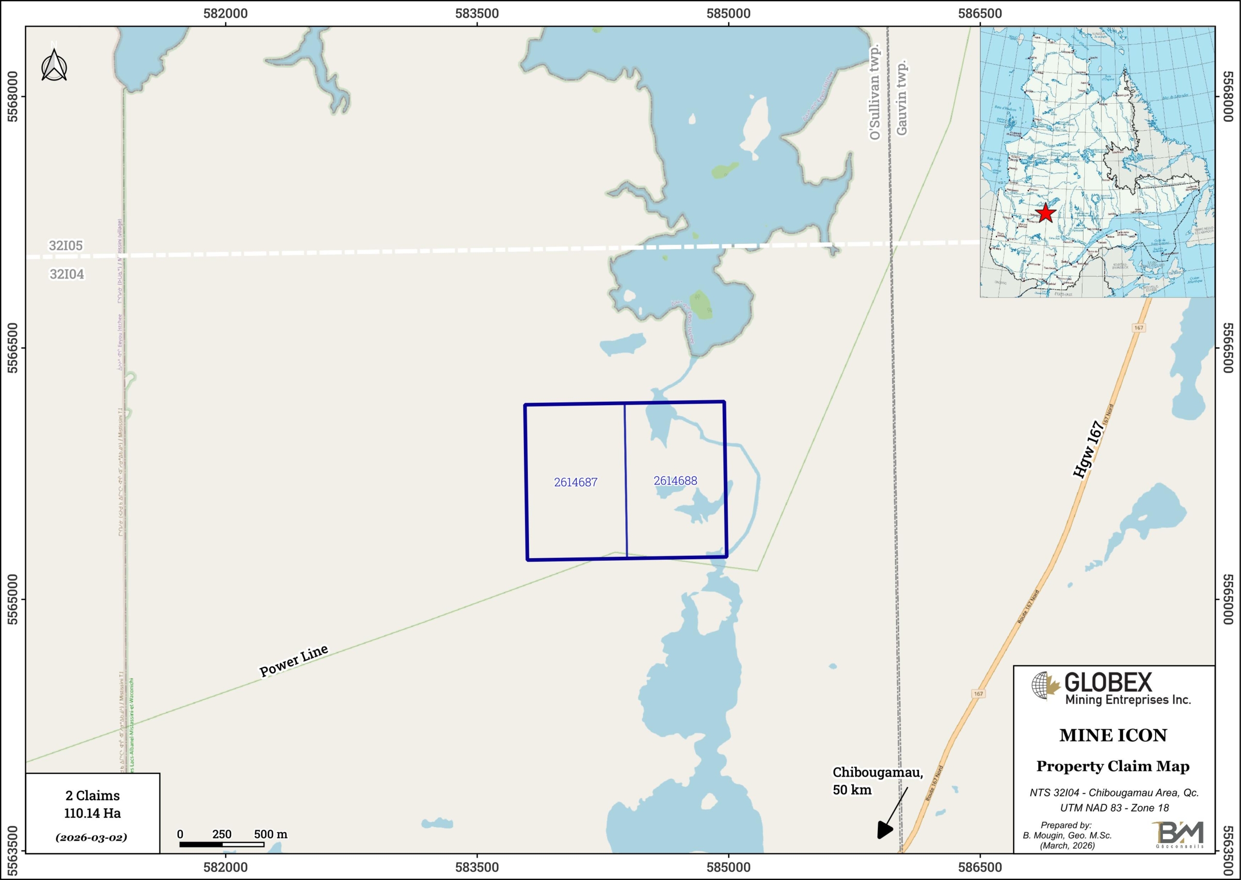
The Mine Icon property is located in Eeyou-Istchee James Bay Government, Northern Québec, Canada (NTS 32I04), approximately 50 km in the O’Sullivan Bignell township. The claims are 100% owned by Globex and are not subject to any royalty or third-parties interests. Forestry roads connecting to Highway 167 provide access to the property by all-terrain vehicle.
Geology and Mineralization
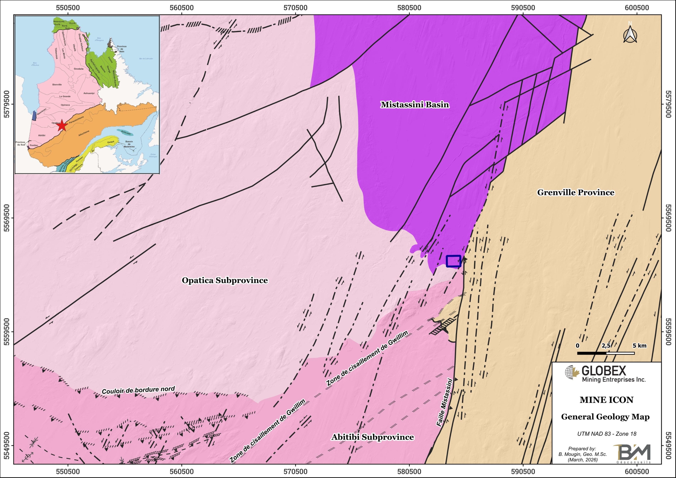
The Mine Icon property is located in the Mistassini Basin of the Opatica Subprovince. Rocks of the Mistassini Basin lie in discordance on the Archean Opatica rocks and are separated from the Grenville Province to the east by the Mistassini Fault. The juxtaposition of these different terranes over geological time has resulted in major regional faults and large-scale hydrothermal systems.
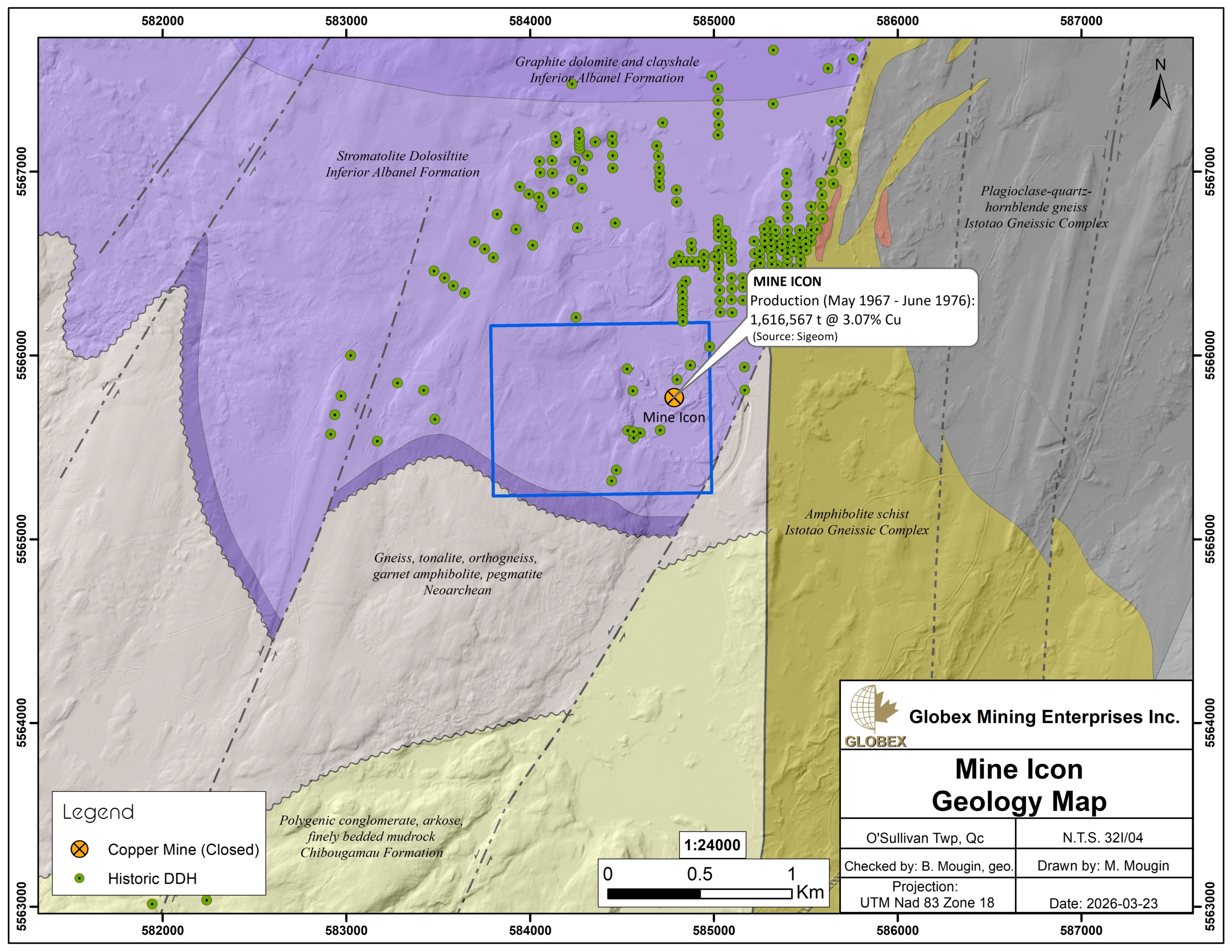
The Mine Icon property area is largely underlain by dolomitic sediments of the lower Albanel Formation which are part of the Mistissini Group. The Mistassini Fault striking N-S immediately east of the property is a major structure separating the Abitibi and Opatica subprovinces to the west from the Grenville Province to the east. The regional metamorphic gradient increases toward the east, in the direction of the Grenville Province.
The Mine Icon property hosts the Icon former copper mine. Copper mineralization occurs in quartz-dolomite veins in the form of conformable layers overlain by graphitic claystone. The quartz-dolomite veins correspond to a mineralized zone containing massive chalcopyrite and pyrite, often associated with marcasite. Pyrrhotite, sphalerite, and bornite are less abundant and are oxidized near the surface. This mineralized zone occurs within a band of graphitic argillite to quartz dolomite in the sequence (Gros, 1975). The Mistassini Fault appears to play a major structural role in controlling the formation of mineralization.

The Mine Icon produced 1.62Mt grading 3.07% Cu between 1967 and 1976. Three main zones were mined using a combination of open-pit and underground mining techniques. The mine closed in June 1976 after the reserves were exhausted except from the mine pillars which are estimated to contain approximately 100,000 tons of ore (GM54870).
History
In 1956, the first geochemical and geophysical surveys were conducted in the area and led to the discovery of the Icon copper deposit in 1965. Several exploration campaigns were carried out to bring the deposit to the production stage in 1967. Exploratory drilling was conducted during the production period in an effort to expand the mineral reserves.
In 2002, the National Institute for Scientific Research (Water-Land-Environment Center) conducted a study of the Mistassini Basin aimed at adapting tools typically used in oil exploration for use in mineral exploration. The method aims to map the alteration halos associated with sulfide mineralization in the Mistassini Basin (Héroux et al., 2004).
In 2023, Globex realised a compilation of historical work on the Mine Icon property (Mijlad, 2023) which provides more details about history, geology and mineralization of the property.
Resources and Potential
Very limited exploration has been done on the Mine Icon property after the mine closure in 1976. A total of 12 DDH (522.72 m) were drilled on the property and date back to 1973 and earlier.
New geophysical surveys with modern methods would help to identify new exploration targets for rock stripping and DDH. A very-high definition magnetic survey combined with gravity would be particularly adapted to highlight unknown massive sulphide lenses below overburden. Exploration for sulfides using classic electromagnetic methods is less effective in this area because of highly conductive graphite bands which prevent the detection of mineralized zones.
The Mine Icon still hosts mineral resource estimated to about 100,000t of ore contained in the mine pillars.