
Mont Paul
Location, Access, Description
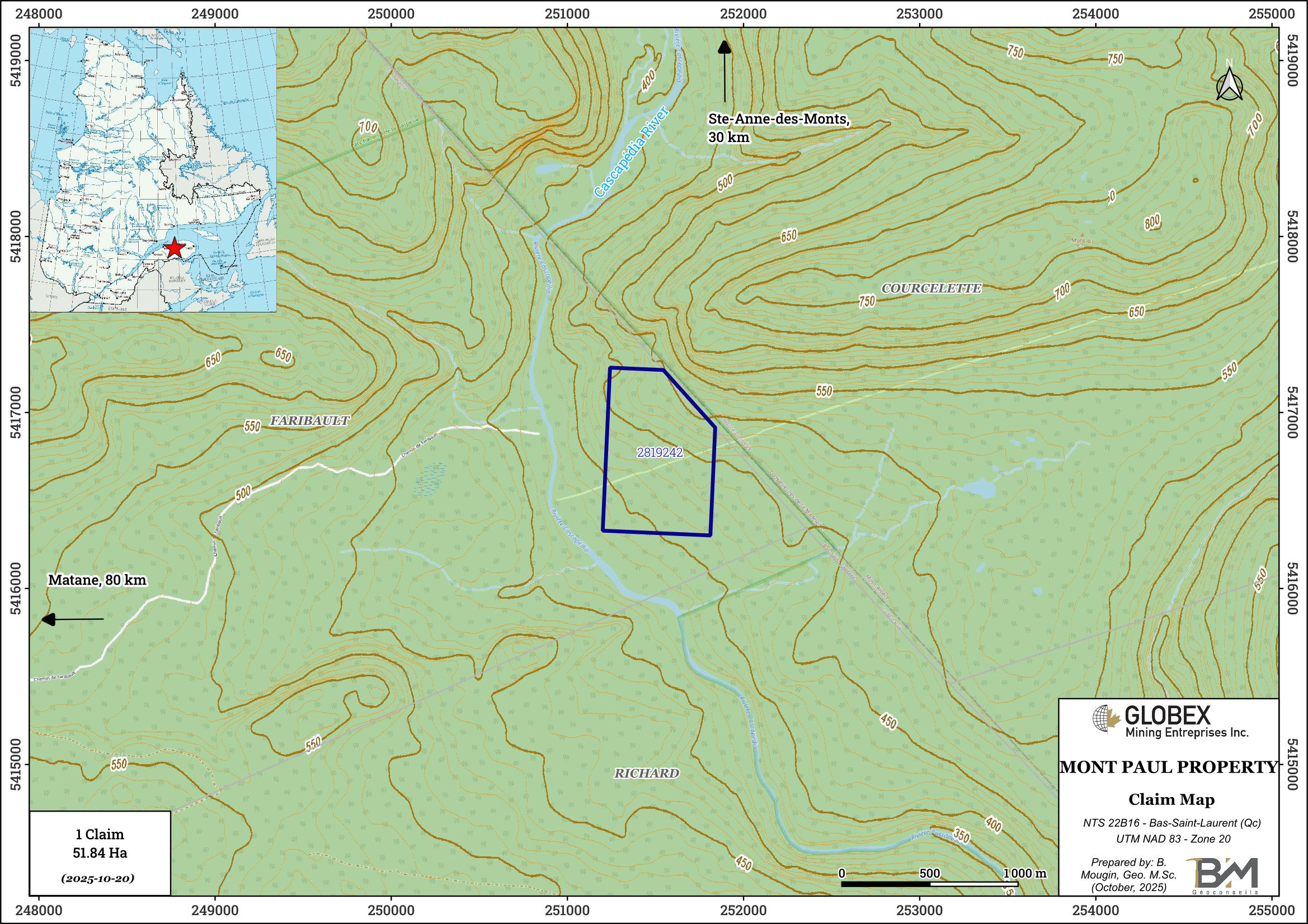
The Mont Paul property is located in eastern Quebec, about 85 km east of Matane at the border between Bas-Saint-Laurent and Gaspesie regions. The property consists of 1 mining claim covering 51.84 Ha. Globex is 100% owner of the property which is not subject to any third-party interests.
Access is possible by truck and VTT from Sainte-Anne-des-Monts via a network of gravel roads and forestry trails. Numerous commodities can be found in Sainte-Anne-des-Monts and Matane regarding contractors, skilled labor, equipment rental, as well as sleep and food accommodation of remote workers.
Geology and Mineralization
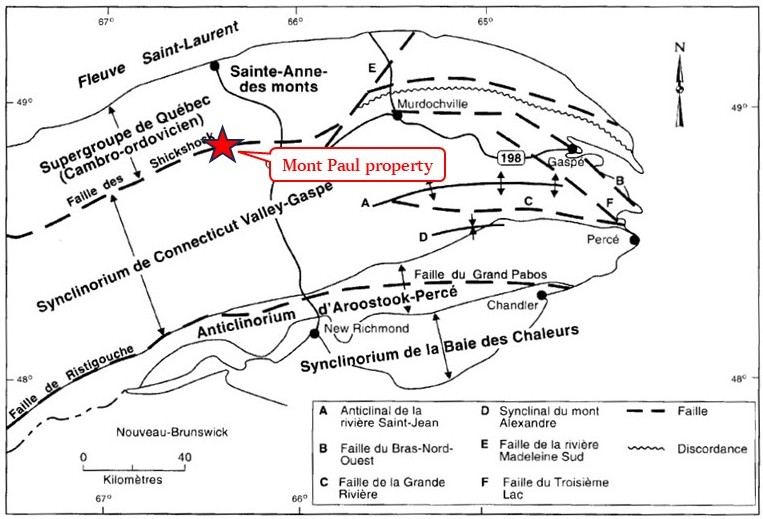
The property is located in the Appalachian Province of the Canadian Shield. The area was mapped several times by geologists of the Quebec Ministère des Ressources Naturelles ; rocks of the Matane area are made up of Paleozoic sediments intruded by granitoids and ultramafic (UM) rocks, and deformed by the Acadian orogeny during the Middle Devonian period.
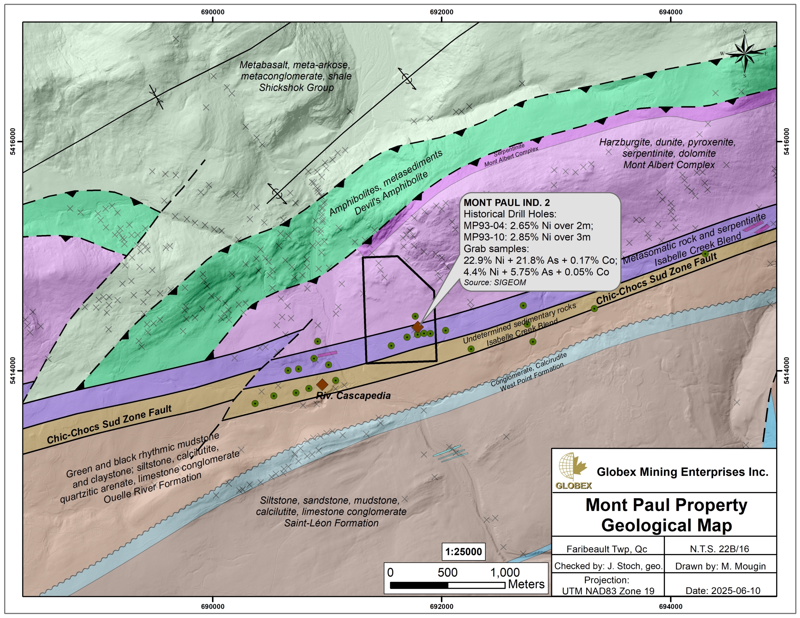
The Mont Paul property is set on ENE-oriented Ordovician metasediments and serpentinized rocks of the Ruisseau Isabelle Formation, intruded by UM rocks of the Mont Albert Complex of Ordovician age too. Rocks of the Mont Albert Complex have overthrusted meta-volcanosedimentary rocks of the Shickshock Group to the north and represent the relics of an ancient oceanic crust (ophiolites).
The property is intersected in its center by the South Shickshocks regional fault which exposes sheared serpentinites.
Metallogeny
The main metal deposits in north-central Gaspé Peninsula have been interpreted as epigenetic Cu and Cu-Mo or Pb-Zn-(Ag) deposits similar to classic copper porphyry deposits and associated polymetallic skarns and veins. The Mines Gaspé, Sullipek and Sullipek-Est, Puma, Castor, and copper deposits on the periphery of the McGerrigle Mountains batholith are all of this type.
In addition to skarn and copper porphyry deposits, there is the possibility of finding epithermal precious metal deposits within and around rhyolitic complexes (ET92-03).
In the Shickshock fault zone, ultramafic and sedimentary rocks underwent intense dolomitization and silicification ; this environment was explored in the 1960s and 1970s by New Jersey Zinc Co. and SOQUEM in search of Ni-Cr deposits.
The Mont Paul property area hosts several Ni (±Co ±Cr ±EGP) showings. The mineralization consists of stockworks of nickel sulfide and arsenide veinlets associated with dolomites and hydrothermal alteration of ultramafic rocks. Assays up to 22.9% Ni and 0.17% Co returned from grab samples on the “Mont Paul ind.2” showing and up to 2.85% Ni over 3 m were intersected by historical DDH in the 1990s.
History
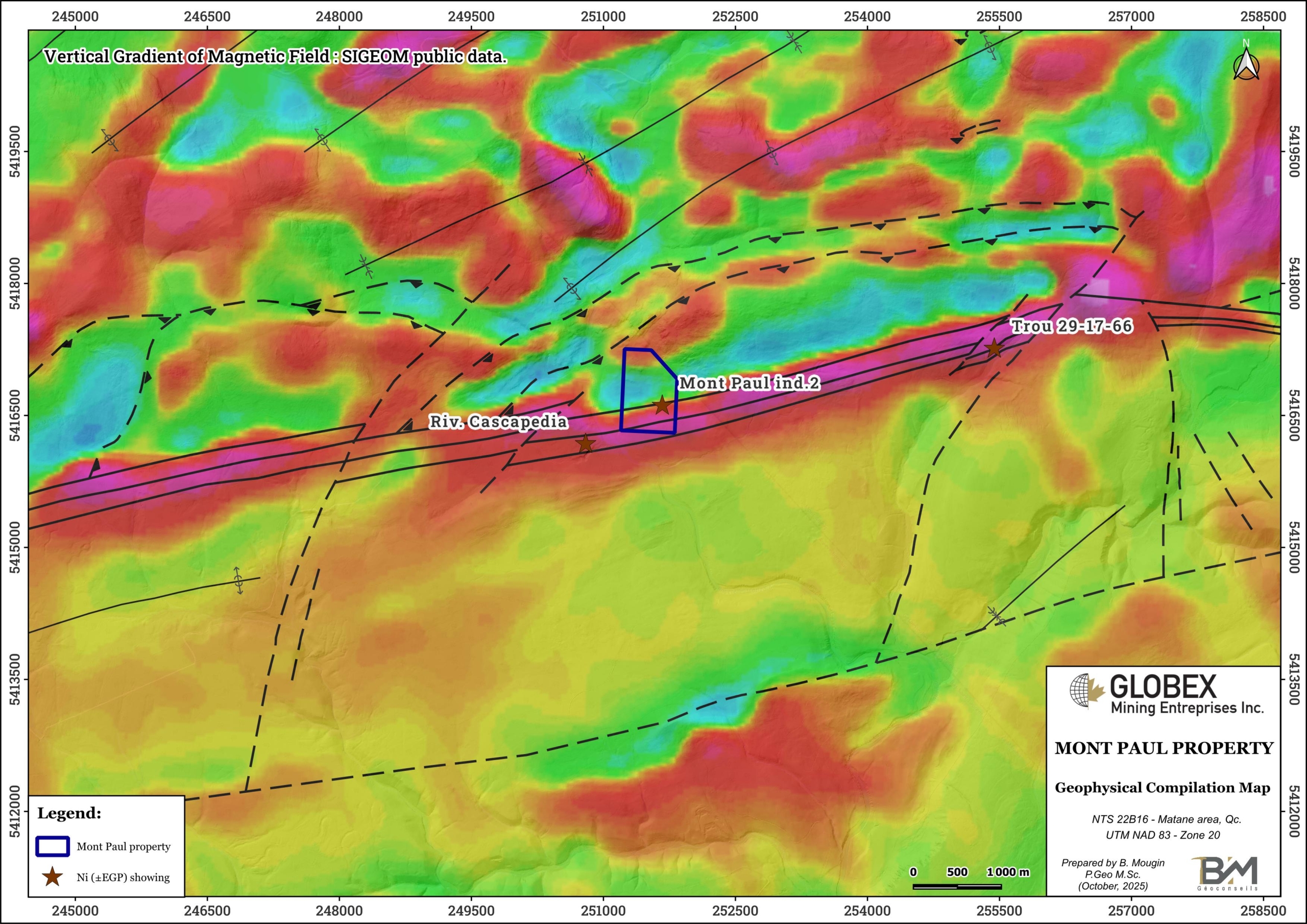
Limited exploration was carried out during recent years in this area. Most of historical work is dated from the 60s (New Jersey Zinc Inc.) to 90s (PELR Exploration Inc.) and included some geological mapping, airborne and ground geophysics (Mag, EM, IP), soil geochemistry and diamond drilling (DDH). Several EM and IP conductors were highlighted (GM51657).
A total of thirty-four (34) historical DDH undertaken between 1966 and 1994 succeeded in defining three (3) Ni (±Co ±Cr ±EGP) showings hosted in dolomitized serpentinites along the South Shickshocks fault in the area of the property. The “Mont Paul ind.2” showing was discovered by surface prospection above a historical DDH in 1992 (GM51950).
Resources and Potential
More exploration is required on the Mont Paul property due to favorable geologic context for Ni-Co-Cr-EGP mineralization in serpentinized ultramafics. Most historic work dates back more than 30 years ago.
Detailed compilation of historical work is recommended and should start with digitization of historical geophysical anomalies and re-interpretation of DDH cross-sections. New ground geophysics combining Mag, EM and induced polarization (IP) methods would definitely help defining detailed exploration targets.