
Pegma
Location, Access, Description
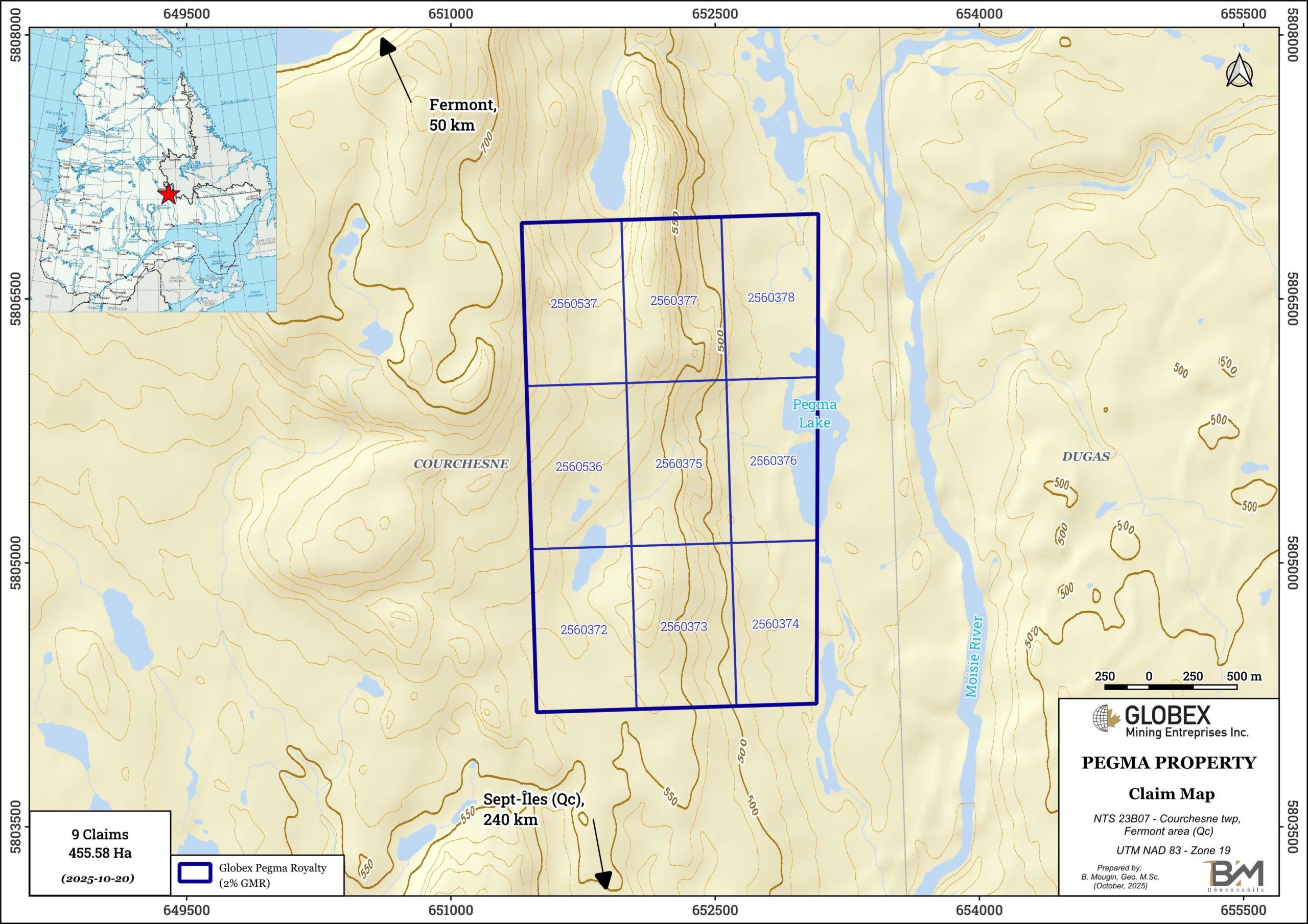
The Pegma property is located in northeastern Quebec, about 50 km south of Fermont (Qc) and 240 km north of Sept-Îles (Qc). The property consists of 9 mining claims covering 455.58 Ha. The claims belong to High Tide Resources Inc. and Globex retains a 2% Gross Metal Royalty (GMR) on it. Access is only by helicopter or float plane from Fermont or Sept-Îles since no road exists in the area. A high-voltage power line crosses the property.
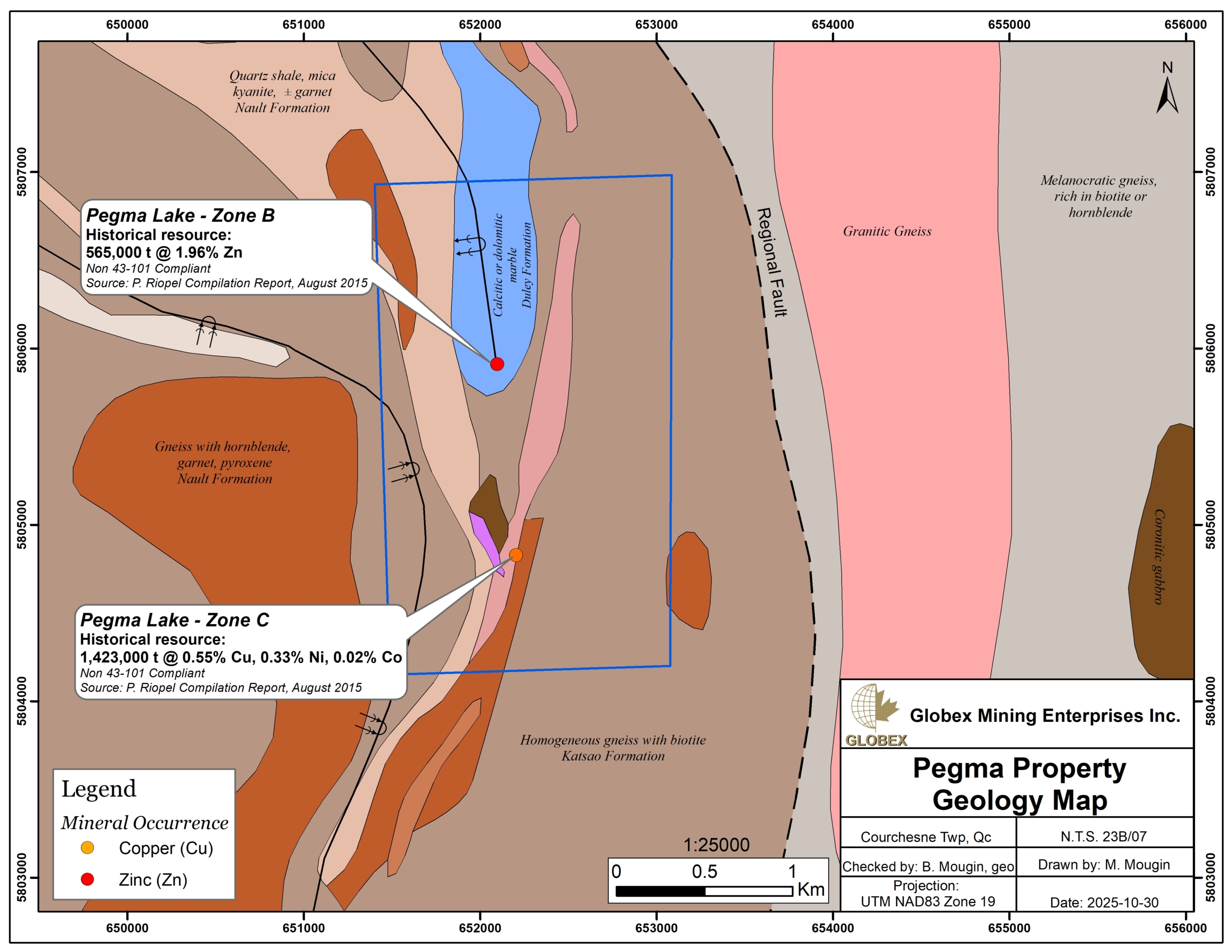
Non NI 43-101 compliant Resource of 1.42 Mt grading 0.55% Cu and 0.33% Ni for the Cu-Ni deposit and 565,000 t grading 1.96 % Zn for the Zn deposit are estimated on the Pegma property.
Geology and Mineralization
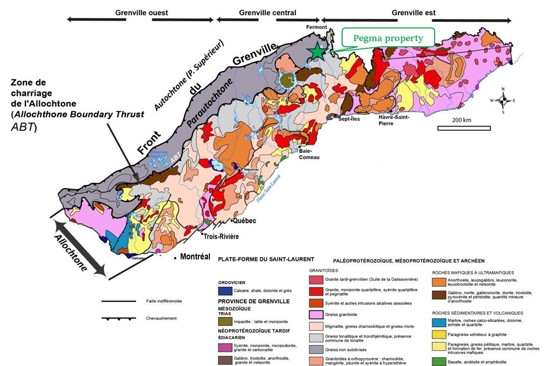
The property is located in the Grenville Province of the Canadian Shield, at the limit between Parautochtone and Allochtone units. The Grenville is composed of ancient Archean or Proterozoic metasedimentary, metavolcanic, and plutonic rocks that were heavily deformed and metamorphosed to the granulite facies. The overlap of the Allochthone on the Parautochtone occurred during the Grenvillian orogenic cycle (1.09 to 0.985 Ga).
The area of Felix and Pegma lakes was mapped by Clarke in 1961 (RP461); rocks of the area are composed of different types of gneiss and migmatites, schists, silicate iron formations, marbles and quartzite. Minor amphibolite, peridotite and pegmatites are also observed.
The Lac Mitaine property is centered on an NNW-oriented anticline whose heart is occupied by Archean marble and quartzite. A large silicate iron formation (Wabush Formation) is observed through the entire property in NNE-orientation. Amphibolite and peridotite of the Shabogamo Suite are present in the southern part of the property.
Metallogeny
The economic interest in the region stems from its potential for iron in oxide iron formations, and base metals such as copper, nickel, and zinc, and for platinum group elements associated with mafic or ultramafic rocks (Clarke, 1962).
The Pegma property hosts two (2) metallic showings. At Lac Pegma-Zone B marble and quartzite are intruded by quartz veins hosting up to 20% sphalerite with varying amounts of pyrrhotine, chalcopyrite, magnetite and marcassite. The sulfides are disseminated or massive and form individual lenses up to 3.5 m wide. Assays up to 14% Zn (grab sample) and 2.58% Zn over 16 m (DDH) are reported in historical work.
At Lac Pegma-Zone C Cu-Ni-Ag mineralization is disseminated at the peridotitic base of an ultramafic sill. Historical grab samples returned assays up to 1.77% Cu, 1.87% Ni, 0.30% Co and 3.43 g/t Ag.
History
Limited exploration was carried out throughout past decades in this area. Some geological mapping and limited diamond drilling (DDH) were done during the 1950s. In 1996, Diadem Resources carried out magnetic and electromagnetic surveys followed by a 5,749 meters (60 holes) DDH program which led to a non NI 43-101 compliant resource estimate of 1.47 Mt grading 0.62% Cu, 0.34% Ni and 0.03% Co on the Lac Pegma-Zone C deposit (GM54771).
In late 2000s, TerraNova Minerals proceeded to a new non NI 43-101 compliant resource estimate of 1.42 Mt grading 0.55% Cu and 0.33% Ni for the Cu-Ni deposit and 565,000 t grading 1.96 % Zn for the Zn deposit.
In 2015, Globex undertook a compilation report on historical work on the Pegma property (GM69107) and concluded that possible extensions of the mineralization still exist and that some EM anomalies were still unexplained.
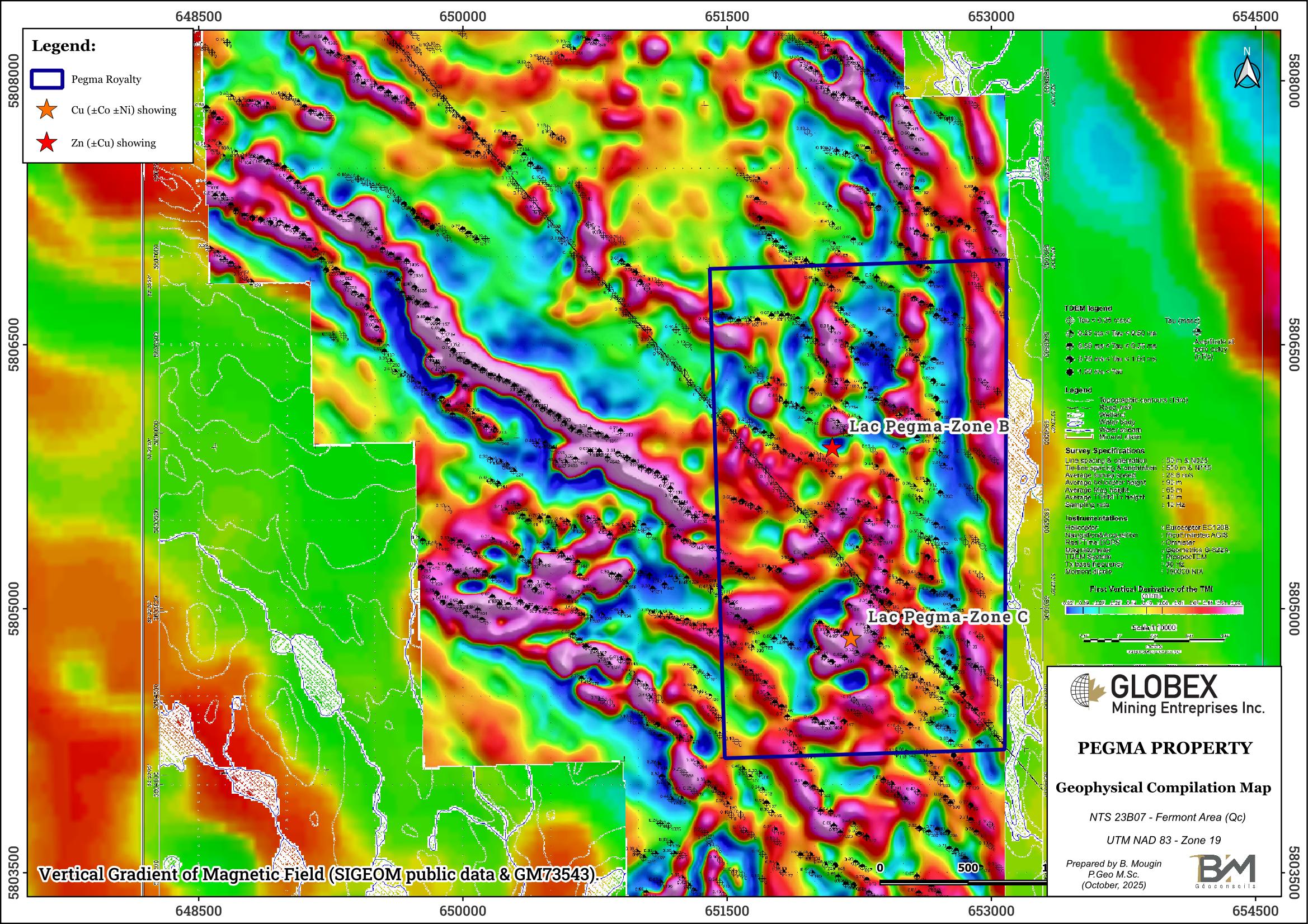
Globex sold the Pegma property to High Tide Resources in 2021 for a 2% GMR. Soon after, High Tide carried out a high-resolution heliborne magnetic and electromagnetic survey (GM73543)on the whole property.
Resources and Potential
More exploration is required on the Pegma property due to favorable geologic environment for Ni-Cu mineralization. Historical DDH succeeded in defining non NI 43-101 resource on both Lac Pegma-Zone B and Lac Pegma-Zone C deposits, and Riopel (2015) estimated that mineralization is still open.
Detailed reinterpretation of historical DDH cross-sections would be necessary to test this observation. New ground geophysical surveys combining Mag, EM and induced polarization (IP) methods would definitely help defining new surface exploration targets.