Poirier Mine
Location, Access, Description
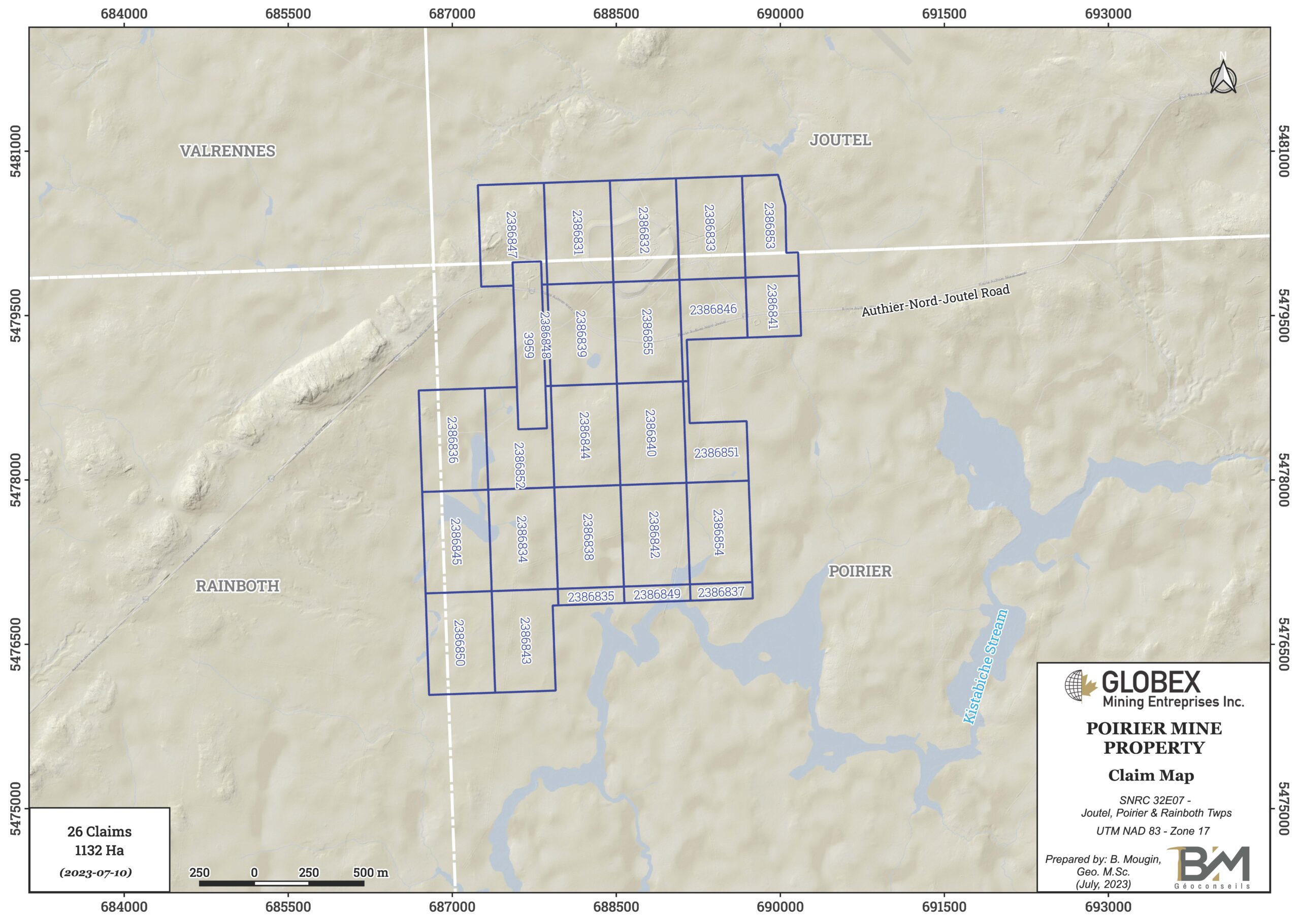
The Poirier Mine property consists of 26 mining claims totalling 1,132Ha west of Joutel village (NTS 32E07), 100km to the north of Amos (Abitibi, Qc). The claims are wholly owned by Globex and are not subject to any underlying royalties or third party interests.
Topography is quite flat and locally swampy with elevations of 300 to 320m high. The entire property is covered with boreal forest. Outcropping conditions are pretty bad. The old Poirier Mine is located in the northern part of the property and has been recovered and seeded with grass.
The property is easily accessible by Provincial Road 109 which links Amos to Matagami. At kilometer 157, the Authier-Nord-Joutel road then leads to the property toward west. A dense network of exploration trails allows to move easily in VTT within the property.
Geology and Mineralization
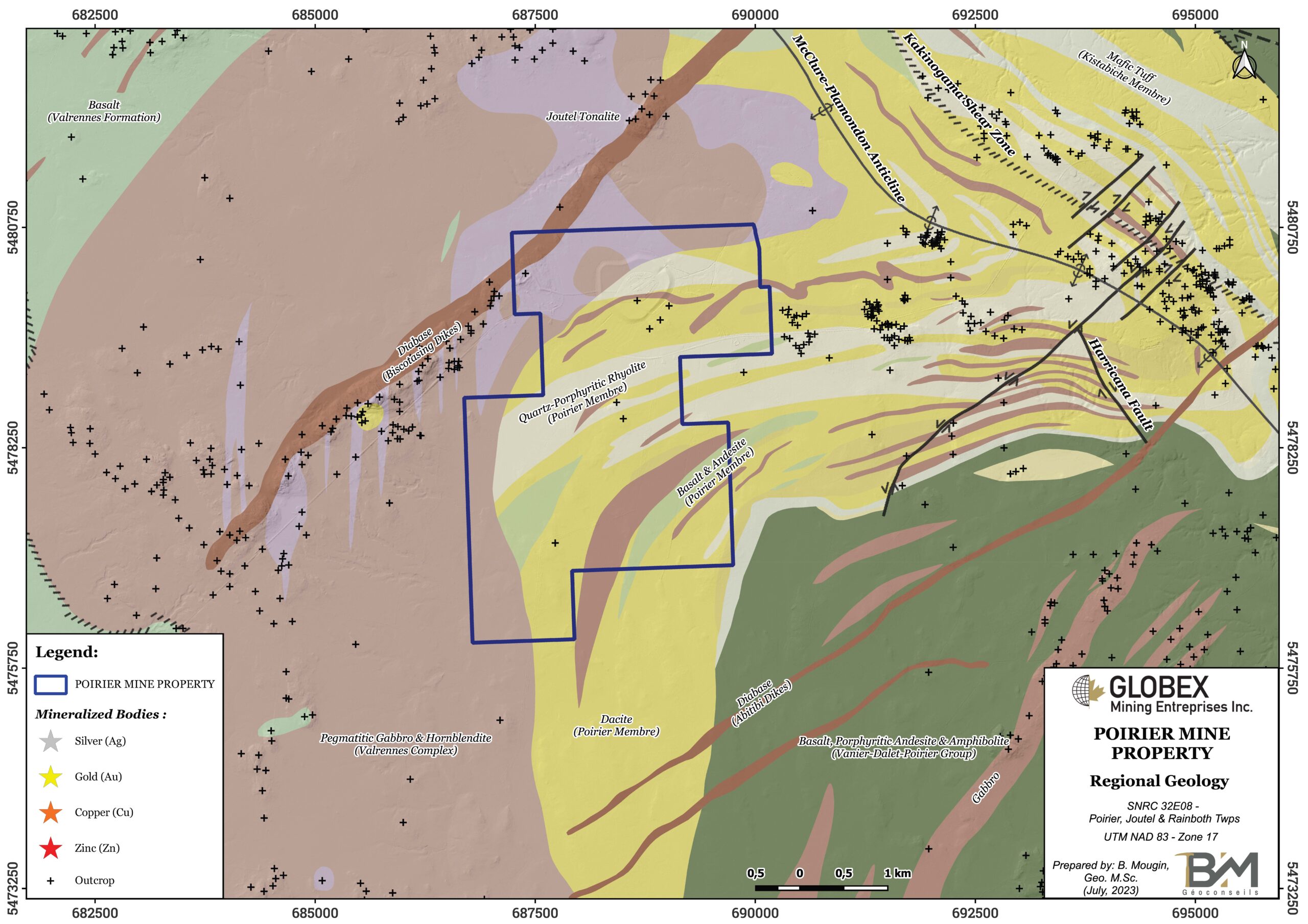
The Joutel mining camp is located in the western part of the Northern Volcanic Zone of the Abitibi Subprovince of Canadian shield. Regional geology of the Joutel area is composed of a N-S homoclinal series of bimodal volcanic and volcanoclastic rocks with polarity toward east (Legault and al., MB2000-10). All these rocks are SE-oriented and were verticalized and metamorphosed to the greenschists / amphibolite facies after three major tectonic events during Archean and Paleoproterozoic.
Rocks of the Poirier Mine property consist of ENE to NE oriented felsic to intermediate volcanics and tuffs alternating with gabbro sills. Both Valrennes mafic Complex and Joutel tonalite can be observed in the western part of the property. The property is surrounded by the synvolcanic Mistaouac Pluton to the west and by the syntectonic Marest Pluton to the east.
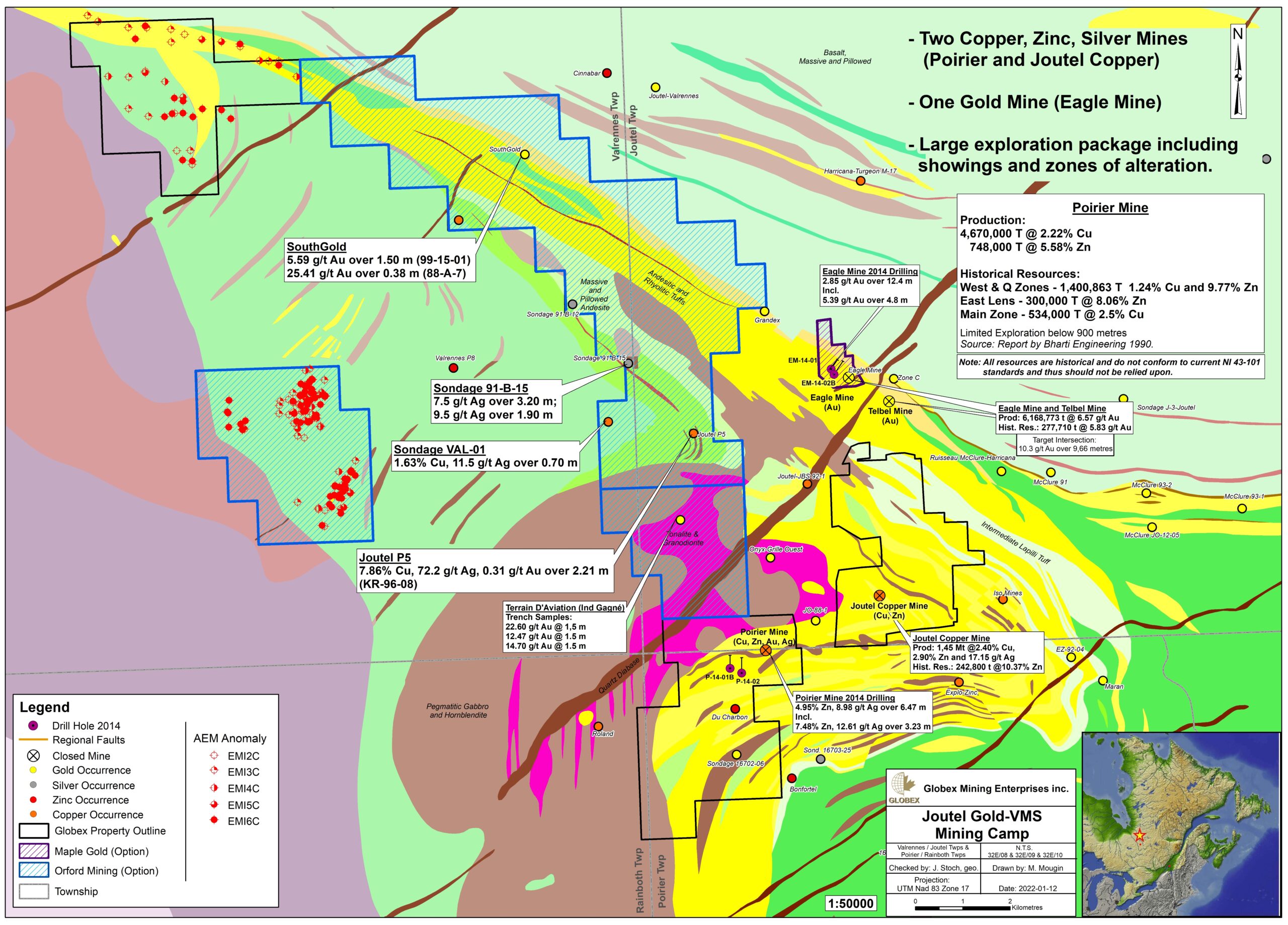
The Poirier Mine deposit is a Noranda type SMV that was discovered during the early 60’s following geophysics and DDH and forms a N90°/70°-80° mineralized lense. It’s composed of massive to disseminated pyrite-sphalerite-chalcopyrite within felsic volcanics and tuffs. The deposit produced 4.67Mt @ 2.2% Cu and 0.75Mt @ 5.58% Zn between 1966 and 1975.
History
Mining exploration in the Joutel area began in 1959 when Rio Tinto Canadian Exploration Limited (Riocanex) carried out an airborne magnetic and electromagnetic survey followed by ground surveys to better locate the electromagnetic conductors detected during the airborne survey. This work was followed by diamond drilling in 1959 and 1960 which delineated the presence of massive sulphides composed essentially of pyrrhotite, pyrite, chalcopyrite (Main Zone) and sphalerite (West and Q Zones). In 1962, a non NI 43-101 compliant resource of 3.5Mt grading 1.74% Cu, 3.63% Zn and 17.14g/t Ag was calculated and underground developments began (GM17991). Production started in 1966 and ended in 1975 after a total production of 4.67Mt @ 2.2% Cu and 0.75Mt @ 5.58% Zn down to a depth of 868 meters.
Limited exploration work was undertaken after the mine closure, including Mag, MaxMin and IP surveys, DDH, and environmental rehabilitation. Between 2000 and 2015, Globex undertook several exploration programs including geophysics, prospection and 2,418m of diamond drilling. P14-002 intersected a massive sulphide lense that returned up to 4.95% Zn and 8.98g/t Ag over 6.47 meters (GM68862).
Resources and Potential
A non NI 43-101 compliant historical resource by LMBDS-SIDAM Group-Conseil in 1986 estimates 585,701 metric tons @ 10.61% Zn and 515,750 metric tons @ 2.45% Cu remaining at Poirier Mine (GM44192).


