
Tiblemont Island
Location, Access, Description
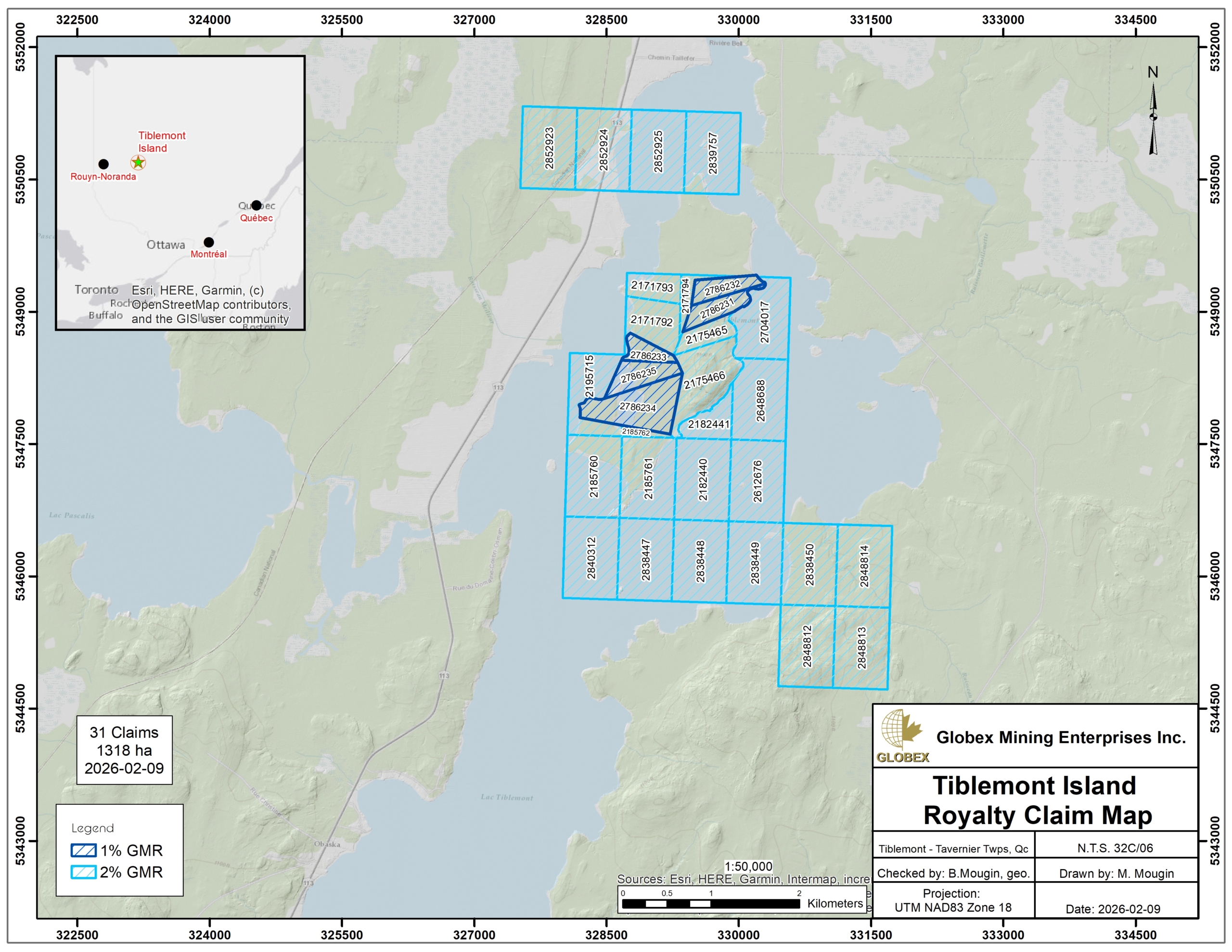
The Tiblemont-Island property is located in the Vallée-de-l’Or county of Abitibi-Temiscamingue, about 12 km south of Senneterre and 40 km NE from Val-d’Or. It is included in NTS sheets 32C03 and 32C06 and consists of 31 non contiguous claims covering a total area of 1,318 hectares on lake Tiblemont. The claims belong partly to Jean Robert and Mosaic Minerals Corp; Globex retains Gross Metal Royalties (GMR) of 1% to 2% on each of the claims.
The property is accessible by Provincial road 113 connecting Val-d’Or to Senneterre, and then by boat to reach the eastern shore of Lake Tiblemont. The property is located on NE-SW-oriented gently rolling hills characterized by elevations up to 350 m above sea level; outcropping areas are limited to hill tops. Food and sleeping facilities as well as many other commodities including daily workers, contractors and equipment rental, are available in Val-d’Or and Senneterre.
The property hosts the former Tiblemont mine which was sunk in the early 1930s to a depth of 150 m but never reached commercial production; historical resources of 226,800 tons grading 3.08 g/oz Au (GM 65613) and 391,000 tons grading 3 g/t Au (GM 74169) are reported in bibliography.
Geology and Mineralization
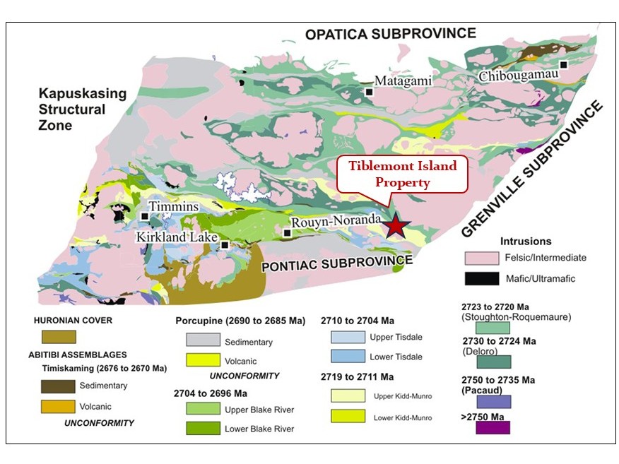
Rocks of the Tiblemont Island property belong to the Superior Province of the Canadian Shield (Card and Ciesielski, 1986). The Abitibi Subprovince is an Archean greenstone belt which hosts some of the richest mineral deposits of the Superior Province. Rocks of the Abitibi greenstone belt are composed of Archean volcanics and sediments intruded by large Archean intrusions. Archean rocks were deformed and metamorphosed to the greenschists facies during the Kenorean orogeny about 2.7 to 2.5 Ga ago.
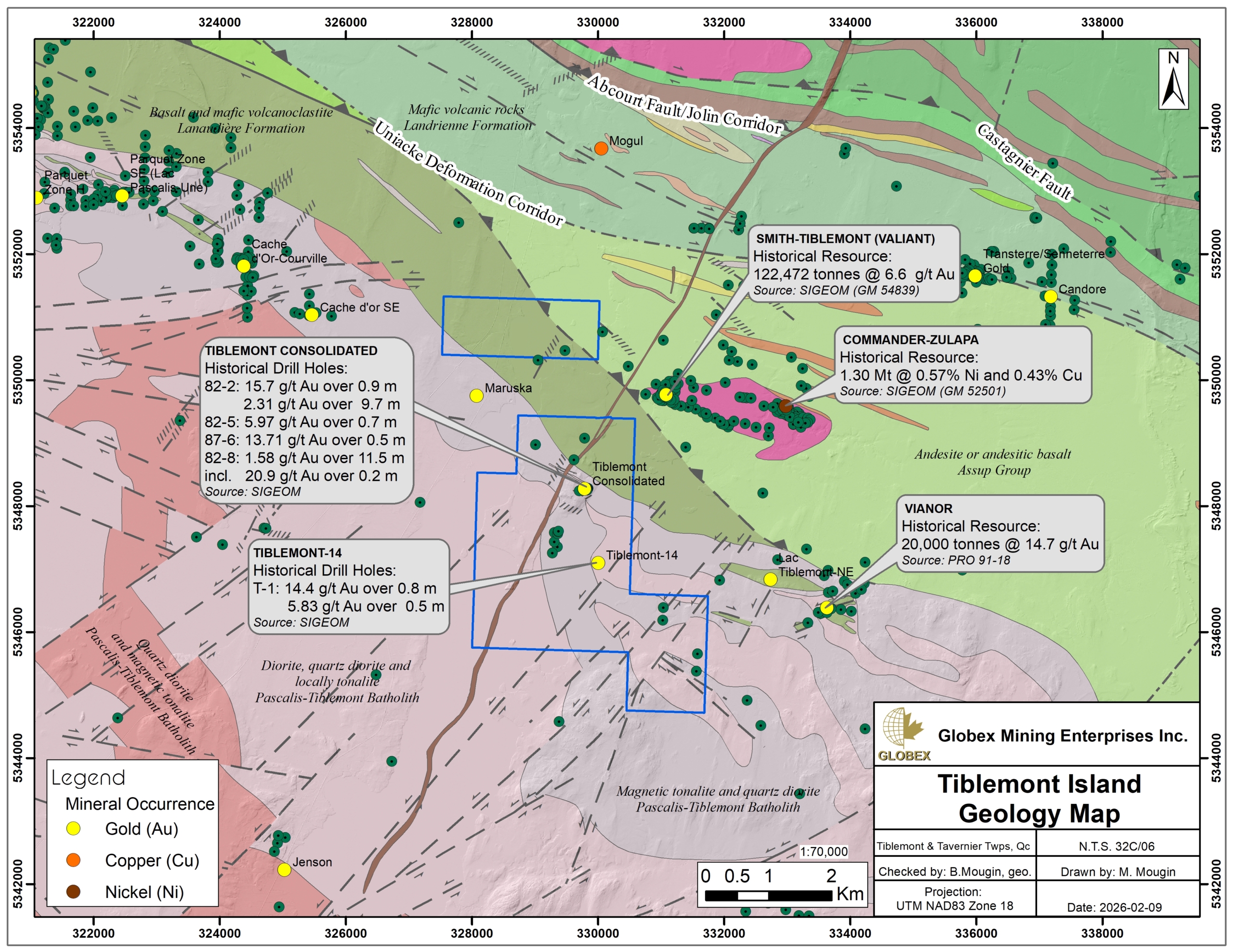
The property is located in the North Volcanic Zone (NVZ) of the Abitibi Subprovince, not far to the northeast of the Val-d’Or mining camp; it lies directly on the northern contact of the Pascalis-Tiblemont batholith, a large multi-phased and synvolcanic intrusive complex, and the volcanic rocks of the Lanaudiere Formation. Rocks of the Tiblemont Island property are composed of granodiorite and tonalite of the Pascalis-Tiblemont batholith to the south, and sheared mafic volcanics to the north; the Tiblemont Island property covers about 2.5 km of this volcanic-batholith contact. Proterozoic mafic intrusions trending NNE cut across all Archean units.
Structurally, the Tiblemont Island property is located at the southeastern edge of the Manneville deformation corridor, a regional structure associated with numerous gold deposits in Abitibi and which appears to be an extension of the Destor-Porcupine fault. The northeast margin of the Tiblemont-Pascalis Batholith coincides with a regional deformation structure referred to as the Uniacke Deformation Corridor. This structure is related to numerous gold occurrences. Gagnon (2024 – GM 74169) noted that “a major deformation/shear corridor affects the granodiorite, generating vertical and sub-horizontal quartz vein systems.”
Several deposits are recognized in the vicinity of the Tiblemont Island property :
– The Smith-Tiblemont (Valiant) gold deposit is located less than 1 km east of the property, with historical resource of 122,472 tonnes grading 6.6 g/t Au or 72,000 tonnes grading 8.91 g/t Au (GM 54839);
– The Commander-Zulapa deposit, located 2 km east of the property, has a historical resource of 1.30 Mt grading 0.57% Ni and 0.43% Cu (GM 52501);
– The Vianor gold deposit, located 2 km east of the property, has a historical resource of 20,000t grading 14.7 g/t Au (PRO 91-18).
The Tiblemont Island property hosts two (2) gold showings, so called the Tiblemont Consolidated showing and the Tiblemont-14 showing. The mineralization is orogenic lode gold, associated with quartz-carbonate veins within faults and shear zones, hosted in volcanics and intrusive rocks. This type of deposit is well known in the region, particularly in the Sigma and Lamaque mines in Val-d’Or, which have been in operation for several decades. The Tiblemont Consolidated showing has historical resources estimated to 226,800 tons grading 3.08 g/oz Au (GM 65613) and 391,000 tons grading 3 g/t Au (GM 74169).
History
The first evidence of gold mineralization was discovered by prospection in 1931 on the Tiblemont Island. A surface outcrop shows granodiorite (Pascalis Batholith) intersected by quartz lenses with a network of quartz veinlets containing abundant free gold. This area became the Tiblemont-Consolidated (Île d’Or) gold showing, also called the southern zone.
Numerous exploratory works were subsequently carried out in the area; a detailed history of the Tiblemont Island property is presented in the NI 43-101 Technical Report prepared by D. Lapointe for Ressources Île d’Or in 2010 (GM 65613).
Recent developments :
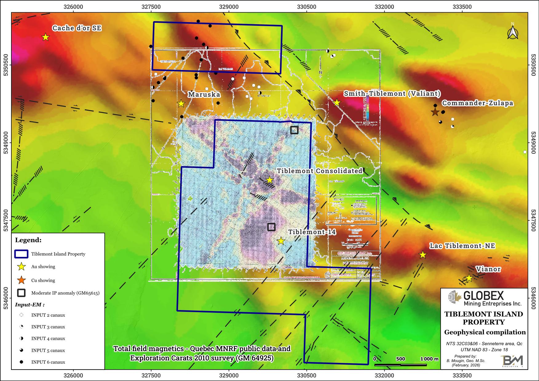
In 2010 and 2011, Exploration Carat (Jean Robert) carried out ground magnetic, electromagnetic and polarization surveys (GM 64925 and GM 65615) which highlighted some weak anomalies.
The most recent work listed on the property concerns a prospection and geological mapping program undertaken by ExploLab for Jean Robert in 2024 (GM 74169). ExploLab located historical installations (shaft, mill…) on the Tiblemont Island property. Old exploration trenches were observed and sampled with several assays > 1 oz/t Au on grab samples; best assay returned 101.2 g/t Au on sample C0292991.
Resources and Potential
Historical work in the area identified a regional favorable context for gold mineralization associated with sheared volcanics and granodiorite along the batholith-volcanics contact.
Following the 2024 grab sampling program, Gagnon recommended to further explore the property with mechanical stripping and channel-sampling.