
Virginia
Location, Access, Description
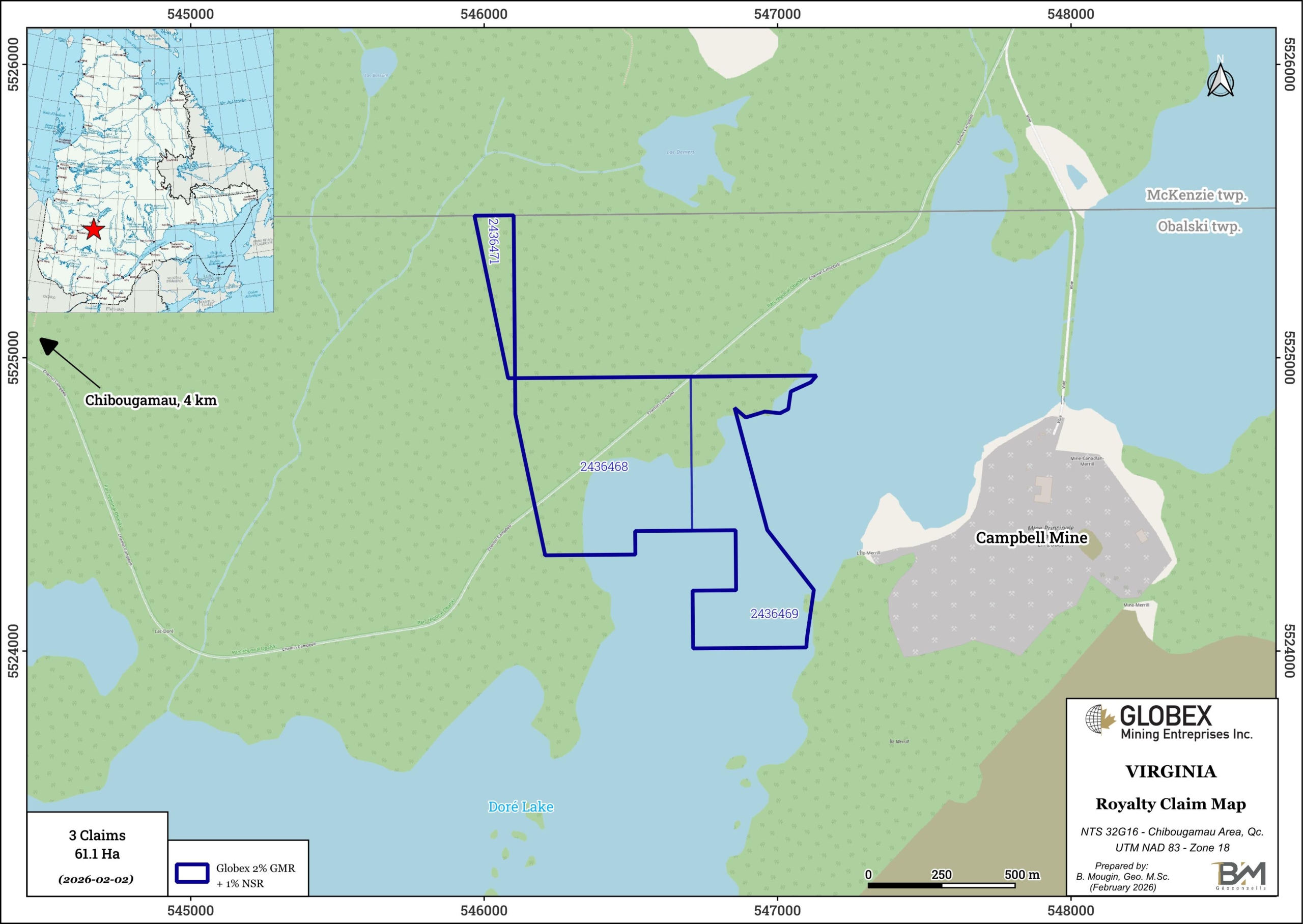
The Virginia property is located in Eeyou-Istchee James Bay Government, Northern Québec, Canada (NTS 32G16), approximately 4 km southeast of Chibougamau. It consists of 3 contiguous claims covering a total area of 61.1 hectares in McKenzie and Obalski townships. The Project is easily accessible in vehicle by all- weather gravel roads connecting to regional highway #167.
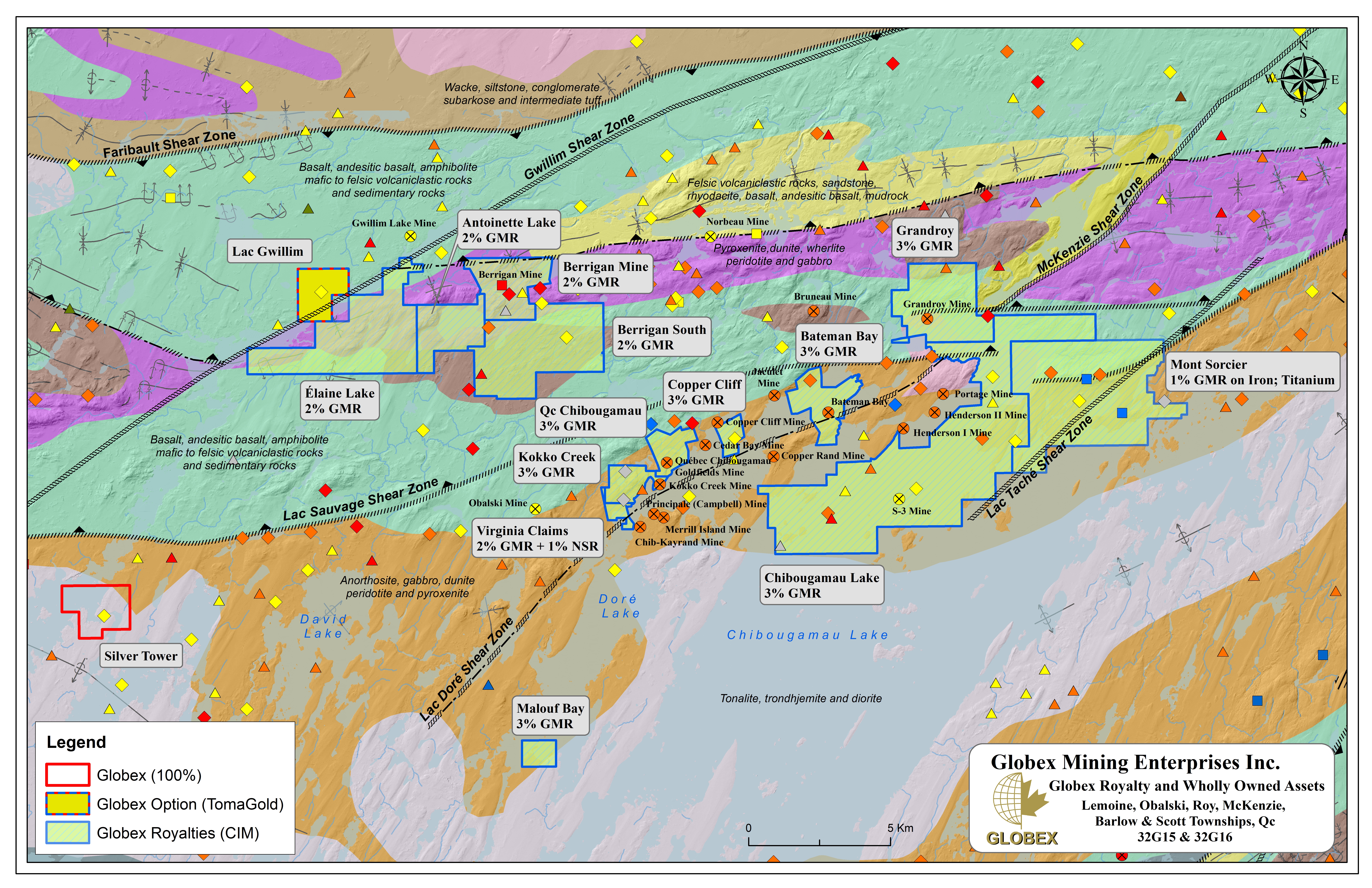
The claims have been stacked by Globex and then transferred in 2012 to Chibougamau Independent Mines (CIM), a subsidiary of Globex ; TomaGold optioned the property from CIM in 2023 (as well as several other properties of CIM ; see the General Map of Globex’s assets in the Chibougamau area), and Globex will retain a 2% Gross Metal Royalty (GMR) and 1% Net Smelter Return (NSR) on it.
Geology and Mineralization
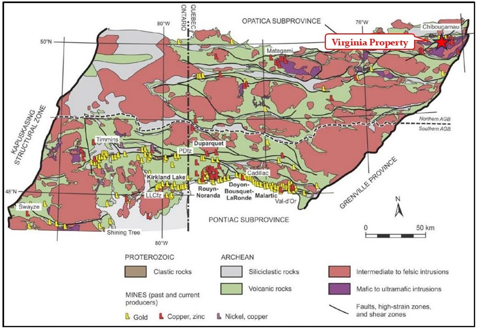
The Kokko Creek property is located in the Superior Province of the Canadian Shield. The Abitibi Sub-province is known for its prolific and diverse rich mineral deposits; total gold production of the Abitibi Greenstone Belt (AGB) since the beginning of the 20th century is estimated at over 210 million ounces (Moz) Au (Dumas, 2024).
The Chibougamau region hosts some of the eldest rocks of the AGB; the area is dominated by a stacking of Archean mafic volcanic rocks intercalated with a few felsic units and some sedimentary units, intruded by two large batholiths : the anorthosite Doré Lake Complex, and the Chibougamau Pluto composed of tonalite and granodiorite. These two intrusions played a major role as regional mineralized features, and the vast majority of mines in the Lake Chibougamau area are located within or near these two intrusions. Regional metamorphism is at the greenschists grade.
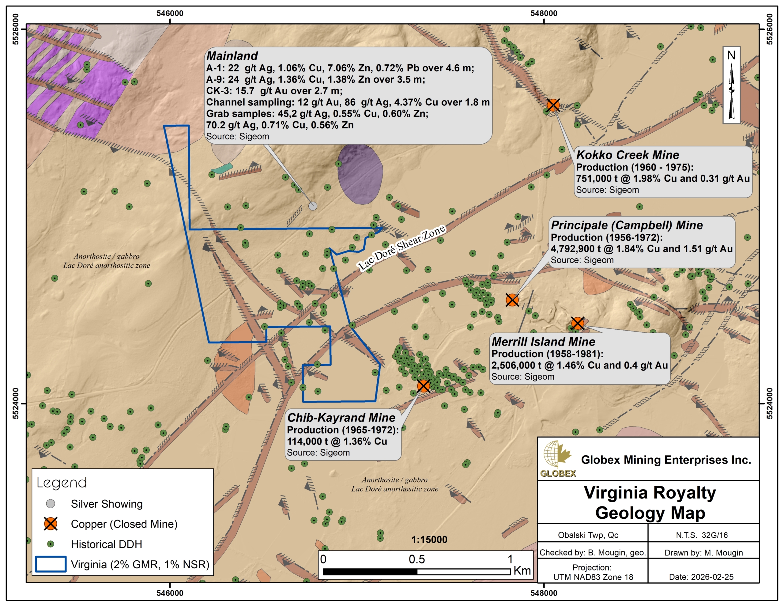
The property area is mostly underlain by anorthosite and gabbroic anorthosite of the Lac Doré mafic to ultramafic intrusive Complex adjacent to the Lac Chibougamau Batholith, located further to the SE. The Virginia property covers an area of altered gabbroic anorthosite associated to the Lac Doré Complex. The rock formations present within property limits are dominated by variably sericitized, massive anorthosite and anorthositic gabbro, always coarse grained.
The Chibougamau Mining District is located in the northeastern part of the Abitibi Greenstone Belt and hosts a variety of deposits styles; Leclerc et al. (2012) documented volcanogenic massive sulphide (“VMS”) deposits, magmatic Fe-Ti-V and Ni-Cu ± PGE mineralization, early polymetallic (Au-Ag-Cu-Zn-Pb) vein deposits (to which the Property mineralization might belong), Chibougamau-type Cu-Au-veins, shear zone-hosted Au deposits, and Opemiska-type Cu-Au veins. Total production of the Chibougamau mining camp since the beginning of the 20th century is estimated at 1,624.9 Mlbs Cu and 3.22 Moz Au (Houle, 2019).
Mineral production from the Chibougamau Mining Camp was derived largely from mesothermal Cu-Au veins. Most of the past producing mines are located within the anorthositic gabbro phase of the Lac Doré Complex. When the Chibougamau Pluton intruded the bedrock, the Lac Doré anorthosites were fractured and filled with metal-bearing hydrothermal fluids.
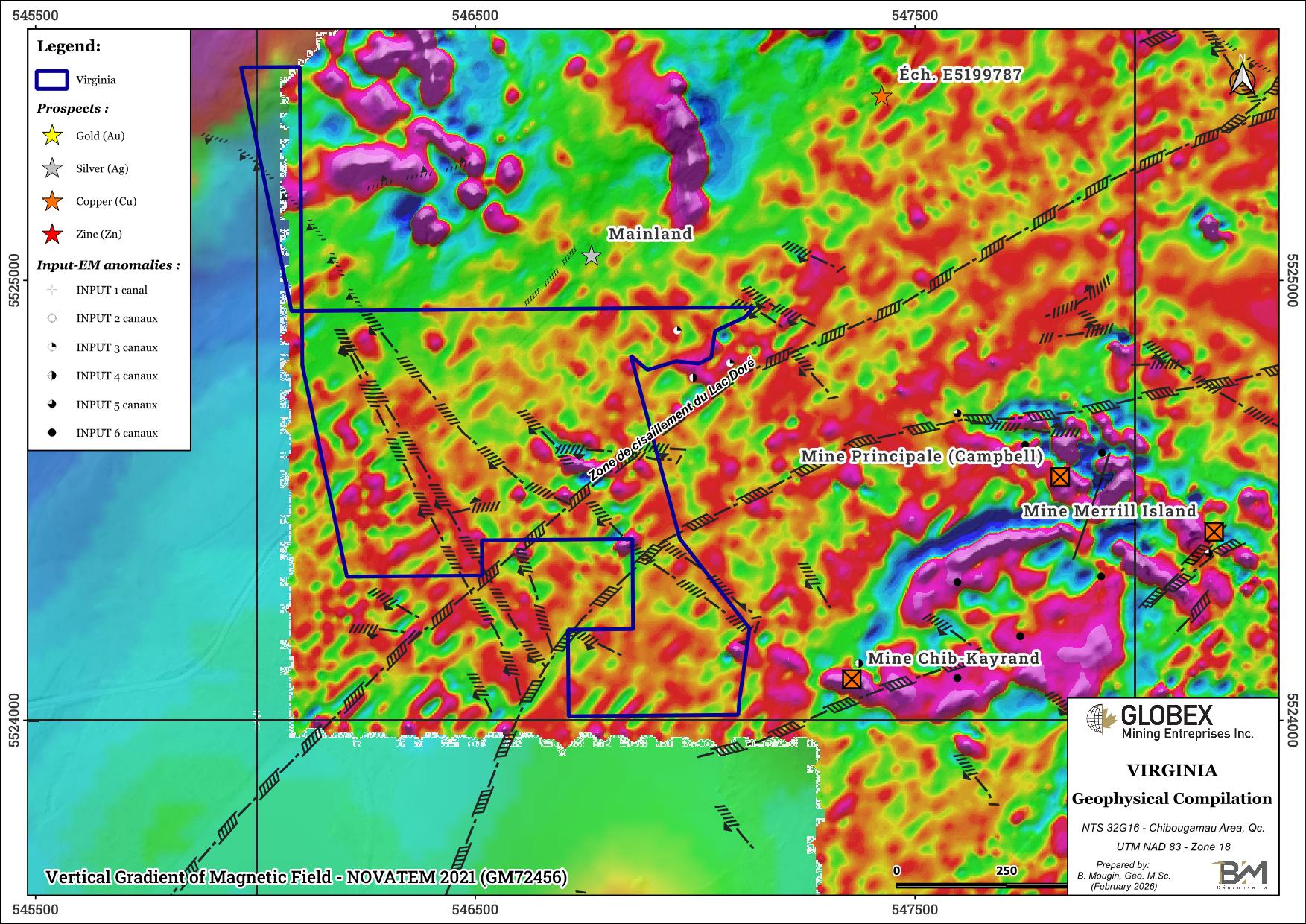
The Chib-Kayrand mine located 250 meters east of the Virginia property produced 114,000 t of ore grading 1.36% Cu between 1965 and 1972. Mineralization is present in most part of the Virginia property in the form of fracture and vein controlled pyrite (Leblanc and Larouche, 2013).
History
Discovery of metallic mineralization in this area dates back to 1906 with the discovery of sulphide mineralization by John Kokko in the future Kokko Creek Mine area, located about 1 km northeast of the property. Numerous exploration programs (mapping, sampling, geophysics, rock stripping, diamond drilling…) have been undertaken by successive owners; more details about the history of exploration on the property is presented in CIM 2013 work report by Leblanc and Larouche (2013).
Several diamond drilling programs have been done on the Virginia property prior to its acquisition by Globex. A total of 6,685 linear metres in 34 DDH have been documented in Quebec public data (Sigéom); most of the drilling dates back to 1972 and earlier.
Recent developments:
In 2021, CIM requested the services of NOVATEM to fly a very-high resolution airborne magnetic survey over several of its properties in the Chibougamau area (GM72456), including the Kokko Creek claims.
TomaGold optioned two (2) blocks of properties from CIM in 2023, including the Virginia claims (CIM Press Release dated August 14, 2023). No work appears to have been carried out by TomaGold on the Virginia property at this time.
Resources and Potential
Historical work in the area identified a regional favorable context for several commodities including gold, silver, copper and zinc. The property potential is supported by favourable geological and structural setting and the presence of well-documented metallogenic and litho-tectonic elements such as the layered anorthositic Lac Doré Complex, and other structures and alteration.
This potential is attested by the presence of several former mines in the direct vicinity of the Virginia property (Kokko Creek, Campbell, Chib-Kayrand, Québec-Chibougamau Goldfields, Copper Rand…); Cu was the principal commodity extracted with minor quantities of Zn, Ag and Au.
Future exploration work on the Virginia property should begin with airborne chargeability and resistivity survey in order to highlight the presence of faults and shear zones. Then follow-up with ground IP on the identified structures should be considered before thinking of rock stripping and DDH.